Situation Summary
Niger remains at composite threat rank #24 globally with a score of 67, reflecting persistent structural instability in border and northern regions but no widespread deterioration in the capital or major commercial centers. A coordinated terrorist assault on a National Guard position in N'Guigmi (Diffa Region) on 31 July killed 14 Nigerien Defence and Security Forces personnel, demonstrating continued militant capability in the southeast despite ongoing counterterrorism operations. No corroborated new incidents have been reported in the 24–48 hours following this attack. The security picture remains characterized by asymmetric threat concentration in remote border areas rather than systemic collapse or capital-region instability.
Key Developments
- N'Guigmi, Diffa Region – 31 July 2026, ~09:30 local
Heavily armed assailants launched a coordinated attack on a National Guard position near the cemetery, resulting in 14 confirmed killed among Nigerien Defence and Security Forces; a subsequent ambush targeted reinforcements. Attackers are assessed as terrorist-affiliated, approaching from the Sabon Carré neighborhood.
- No new verified incidents reported 1–2 August 2026
Open-source monitoring, Nigerien state media, and regional security bulletins show no corroborated attacks, kidnappings, infrastructure disruptions, or mass casualty events in the 24–48 hours following the N'Guigmi incident.
- Persistent border-region threat posture (context: ongoing since 2015+)
Diffa, Tillabéri, Agadez, and northern Tahoua remain operationally active zones for transnational militant groups; the 31 July assault reflects sustained organizational capacity and territorial access in the southeast.
Highest-Risk Areas
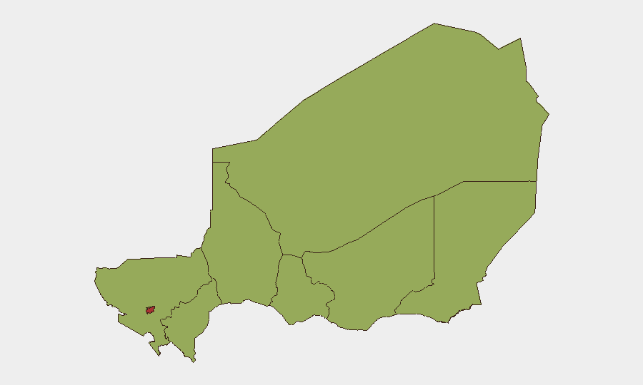
Niamey (risk 77) is isolated at the top of the sub-national ranking, reflecting the capital's status as a high-value political and economic target, though no acute incidents are currently documented there. The remaining seven regions—Agadez, Zinder, Diffa, Tillabéri, Tahoua, Dosso, and Maradi—cluster at risk score 47, indicating a uniform baseline of structural threat tied to porous borders, limited state presence, trafficking networks, and militant sanctuary areas. Diffa's recent attack and its position as a primary militant operational theater make it the most active flashpoint; Agadez and Tillabéri follow as secondary concern zones due to cross-border connectivity with Mali and Burkina Faso. The flatness of the regional risk distribution (47 across most zones) signals that risk is geographically distributed rather than concentrated, complicating protective response and necessitating broad-area monitoring.
How GeoBit Would Assist
Corporate security and duty-of-care teams would use AOI Monitoring & Early Warning to establish persistent watch zones in Niamey, Diffa, Agadez, and critical transit corridors, with automated alerting on new security incidents, protest activity, or state force movements. Intel Sweep combined with multi-language OSINT (X, Telegram, local media) would provide near-real-time visibility into militant communications, state security responses, and cross-border activity that precedes formal reporting. Routing & Network Analysis would enable security teams to identify and update alternative supply and personnel routes away from highest-risk regions and known ambush corridors.
7-Day Outlook
No immediate escalation indicators are visible; however, the 31 July attack pattern (coordinated multi-element assault, capacity to overwhelm a National Guard position, effective targeting) suggests sustained operational readiness among Diffa-based militants. Reinforcement of National Guard postures and potential retaliatory sweeps are likely in the short term, which may temporarily disrupt civilian movement and commercial activity in Diffa and Zinder regions. The baseline threat remains elevated but non-systemic; capital and major commercial zones are not assessed to be under acute pressure.
Highest-Risk Areas — Ranked
| # | State / Region | Risk |
|---|---|---|
| 1 | Niamey | 77 |
| 2 | Agadez Region | 47 |
| 3 | Zinder Region | 47 |
| 4 | Diffa Region | 47 |
| 5 | Tillabéri Region | 47 |
| 6 | Tahoua Region | 47 |
| 7 | Dosso Region | 47 |
| 8 | Maradi Region | 47 |
Sources
Previous Daily Briefs
A new Niger brief is written every day — each with its own risk map and downloadable CSV. Here's the last week; use the calendar to go further back.
📅 Browse every day by calendar →
Highlighted days have a brief. Tap a day for that day's map & analysis, or “csv” for that day's dataset ($5).
Atlas — our AI intelligence desk — emails them this snapshot personally. Nothing else, no list.