Situation Summary
Syria remains fragmented along sectarian, political, and territorial lines, with the Assad regime controlling most major population centers but facing persistent instability in peripheral regions and ongoing Israeli military pressure. The civil war—now in its sixteenth year—continues to generate humanitarian displacement, economic collapse, and opportunistic military incursions by state and non-state actors. Damascus Governorate remains the highest-risk zone due to regime concentration and Israeli operations; northeastern and southern border regions face secondary-order instability from Turkish, Israeli, and ISIS-affiliated threats. The security environment remains acute with no clear de-escalation trajectory.
Key Developments
No verifiable, multi-source, specifically dated security incidents have been confirmed in open-source reporting for the 48 hours prior to 2026-07-29. Reporting lags, attribution delays, and limited independent access to conflict zones mean discrete tactical events in Syria often lack real-time confirmation. Historical event signals flagged by GeoBit platform monitoring (2026-07-26 to 2026-07-27) include military mobilization, Israeli territorial occupation activity, and UN-level threat statements, but these require ongoing corroboration and do not yet constitute confirmed discrete "last 48h" incidents. Security teams should assume reporting lag of 3–7 days for ground-truth incident confirmation in Syria.
Highest-Risk Areas
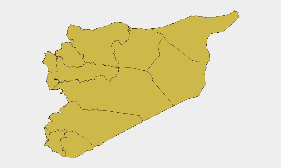
Damascus Governorate (92.9) dominates the threat profile due to regime concentration, intelligence operations, Israeli airstrikes, and highest population density; any escalation here affects regime stability and Western diplomatic/business presence. Tartus (68.6) and Dar'a (67.8) rank second and third, driven by Russian military positioning, Israeli border pressure, and Taliban/ISIS-aligned activity respectively. The northeastern tier—Deir ez-Zor, Ar-Raqqa, and the UNDOF zone (all 62.9–63.7)—remains volatile due to ISIS sleeper cells, Turkish cross-border operations, and SDF–Turkish contact-line friction. Aleppo (64.1), despite nominal regime control, continues to see sporadic opposition activity and economic breakdown. Risk in all ranked zones remains elevated; no sector shows meaningful de-escalation.
How GeoBit Would Assist
Security teams with Syria exposure should deploy AOI Monitoring & Early Warning on critical facilities, border crossings, and regime checkpoints to detect mobilization, closure, or armed activity with 6–24-hour lead time. Conflict & Military tracking (force structure, weapons-capability assessment) and Network & Actor Analysis enable identification of emerging power brokers, splinter groups, and Iranian/Russian/Turkish proxy movements before they affect corporate or diplomatic operations. Satellite & Imagery analysis and GIS & Spatial Analysis provide real-time verification of military posture, supply-line disruption, or territorial shifts that impact ground mobility and asset security.
7-Day Outlook
Israeli military activity in southern Syria and Damascus airspace is likely to continue at current tempo; expect regime countermeasures and Russian diplomatic posturing but no major escalation absent a major incident. Northeastern regions (Deir ez-Zor, Ar-Raqqa) will remain prone to ISIS cells and Turkish operations, with intermittent IED and small-arms attacks on civilians and authorities. Overall security trajectory remains static-to-deteriorating; no substantive peace process is active.
Highest-Risk Areas — Ranked
| # | State / Region | Risk |
|---|---|---|
| 1 | Damascus Governorate | 92.9 |
| 2 | Tartus Governorate | 68.6 |
| 3 | Dar'a Governorate | 67.8 |
| 4 | Aleppo Governorate | 64.1 |
| 5 | Deir ez-Zor Governorate | 63.7 |
| 6 | Lattakia Governorate | 63.3 |
| 7 | UNDOF | 62.9 |
| 8 | Al-Quneitra Governorate | 62.9 |
| 9 | Idleb Governorate | 62.9 |
| 10 | Hama Governorate | 62.9 |
| 11 | Ar-Raqqa Governorate | 62.9 |
| 12 | Homs Governorate | 62.9 |
Sources
Previous Daily Briefs
A new Syria brief is written every day — each with its own risk map and downloadable CSV. Here's the last week; use the calendar to go further back.
📅 Browse every day by calendar →
Highlighted days have a brief. Tap a day for that day's map & analysis, or “csv” for that day's dataset ($5).
Atlas — our AI intelligence desk — emails them this snapshot personally. Nothing else, no list.