Situation Summary
Central African Republic remains in a state of fragile stability characterized by persistent armed-group activity in border regions and humanitarian displacement, with no major new security incidents reported in the last 24–48 hours. The UN Security Council's 29 July extension of sanctions and arms restrictions on non-state actors signals sustained international engagement but also underscores the structural nature of the threat. Security operations around Am-Dafock (Vakaga) and Birao continue following the 30 June attack, and northeastern and southeastern border zones remain elevated-risk areas. Overall trajectory is one of containment rather than resolution, with baseline risk remaining elevated outside Bangui.
Key Developments
- UN Security Council Resolution 2827, New York, 29 July 2026 – Unanimous adoption extending sanctions (asset freezes, travel bans, arms embargo) against non-state armed groups and designated individuals until 31 July 2027, and extending the UN expert panel mandate to 31 August 2027. Signals continued constraint on non-state actor logistics and funding networks.
- CAR Situation Review, UN Headquarters, 29 July 2026 – Security Council members and UN briefers reiterated that while progress has been made, security in northeastern and southeastern border regions remains fragile, with armed groups continuing to pose a threat to stability and civil movement.
- Vakaga Prefecture (Am-Dafock / Birao axis), week of 29 July 2026 – Vakaga governor reported during a visit that Am-Dafock is now secure following joint CAR government and MINUSCA deployments. Ongoing military presence and crisis-management cell activity indicate heightened controls and force reinforcement in the area.
- Border Region Assessment, 29 July 2026 – French and UN diplomatic briefings confirmed that armed group activity "particularly in the northeastern and southeastern border regions" continues to threaten stability, with implications for overland movement and cross-border operations despite the absence of newly reported clashes.
- Government vs. Non-State Differentiation, 29 July 2026 – Security Council decision maintains arms embargo on non-state actors while continuing to allow government resupply, reinforcing state capacity to conduct security operations and likely increasing checkpoint density along key supply routes and in urban areas.
- Countrywide Incident Review, 24–48 hour window (29–30 July 2026) – No newly verified discrete security incidents with precise location and timestamp coordinates reported; underlying threat from armed groups and civil fragility assessed as structurally high, particularly outside Bangui and in border prefectures.
Highest-Risk Areas
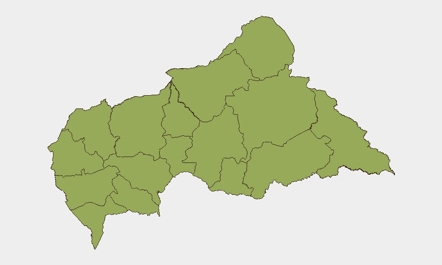
All twelve prefectures carry identical composite risk scores of 48.2, reflecting the diffuse nature of armed-group presence across CAR's territory. However, northeastern (Vakaga, Haute-Kotto, Haut-Mbomou) and southeastern (Mbomou, Haut-Mbomou) border zones are explicitly cited in current UN assessments as areas of active armed-group operations and displacement risk. Vakaga in particular warrants operational attention following the Am-Dafock attack and ongoing military consolidation. Road movement, humanitarian transit, and cross-border trade in these corridors remain subject to armed checkpoints and sporadic tactical activity.
How GeoBit Would Assist
Security teams would deploy AOI Monitoring & Early Warning on border prefectures (Vakaga, Haute-Kotto, Mbomou) to detect tactical activity and displacement patterns in real time. Conflict & Military mapping and force structure tracking would support understanding of MINUSCA and CAR government deployments and armed-group positioning. Routing & Network Analysis would enable alternative journey planning and risk assessment for personnel and asset movement, integrating live checkpoint and armed-group activity data.
7-Day Outlook
No major escalation is forecast in the immediate term; operations appear to be consolidating around Am-Dafock and border checkpoints rather than expanding. However, the absence of reported new incidents should not be interpreted as risk reduction—armed groups remain operationally capable and sanctions enforcement may increase tension. Personnel and asset security protocols should remain at elevated levels, particularly for northeastern and southeastern travel corridors.
Highest-Risk Areas — Ranked
| # | State / Region | Risk |
|---|---|---|
| 1 | Bamingui-Bangoran | 48.2 |
| 2 | Vakaga | 48.2 |
| 3 | Haute-Kotto | 48.2 |
| 4 | Haut-Mbomou | 48.2 |
| 5 | Mbomou | 48.2 |
| 6 | Nana-Mambéré | 48.2 |
| 7 | Ouham-Pendé | 48.2 |
| 8 | Mambéré-Kadéï | 48.2 |
| 9 | Sangha-Mbaéré | 48.2 |
| 10 | Ouham | 48.2 |
| 11 | Nana-Grébizi | 48.2 |
| 12 | Kémo | 48.2 |
Sources
Previous Daily Briefs
A new Central African Republic brief is written every day — each with its own risk map and downloadable CSV. Here's the last week; use the calendar to go further back.
📅 Browse every day by calendar →
Highlighted days have a brief. Tap a day for that day's map & analysis, or “csv” for that day's dataset ($5).
Atlas — our AI intelligence desk — emails them this snapshot personally. Nothing else, no list.