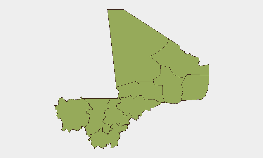
Situation Summary
Mali remains at elevated insurgency risk (composite threat score 69, #28 globally) with all 11 sub-national regions rated at identical composite risk (48.2), reflecting a widespread and territorially distributed threat environment. No verified incident-level security events (attacks, armed clashes, infrastructure sabotage, or major unrest) have been independently confirmed in the last 24–48 hours as of 31 July 2026, though the threat posture remains acute, particularly in northern and central regions. The operational security situation is best characterized as volatile with capability gaps among Malian military forces, evidenced by recent heavy combat losses in late July, but without discrete new incidents to report in the immediate window.
Key Developments
- No verified incident-level events reported in Mali in the last 24–48 hours (as of 29–31 July 2026). Credible open sources, news wires, and social-media monitoring confirm absence of new attacks, clashes, arrests, or major infrastructure disruptions within this window.
- Anefis–Gao corridor (27–28 July, outside 48h window but operationally significant). Confirmed ambush of Malian military convoy resulted in approximately 50 soldiers killed and at least 24 captured; event is several days old relative to 31 July reporting cycle but indicates persistent Islamist or JNIM operational capability in northern transit corridors.
- French foreign ministry maintains blanket travel advisory against all Mali travel (updated post-April 2026 major attacks). No new advisory changes or incident triggers reported in last 24–48 hours; advisory remains precautionary rather than reactive to fresh events.
- Fuel and arms logistics (24–25 July, outside 48h window). Convoys via Kayes and Burkina Faso/Sissako successfully reached Bamako; no corroborated disruptions to supply lines reported in last 48 hours.
- Amnesty International calls for war-crimes investigation into Anefis attack casualties (29 July reporting); investigation notice is current but documents events from 27–28 July and does not reflect new security developments in the 24–48h window.
Highest-Risk Areas
All 11 tracked sub-national regions carry identical composite risk scores (48.2), indicating threat is diffuse rather than concentrated. Northern regions—Ménaka, Kidal, Gao, and Timbuktu—historically host JNIM and ISIS-affiliated insurgent cells and remain primary drivers of the national threat composite. Central regions (Mopti, Ségou) show rising activity as insurgent networks expand southward and compete for territorial control. Even Bamako and southern Koulikoro/Sikasso register equivalent risk due to urban security fragmentation, criminal networks, and periodic protest activity. The uniformity of sub-national risk scores reflects a nationwide diffusion of insurgency capability rather than a single hotspot, complicating resource allocation for both government and corporate security teams.
How GeoBit Would Assist
Security teams with personnel or assets in Mali should deploy GeoBit's AOI (area-of-interest) monitoring and early warning capability to track northern and central regions in real time, coupled with OSINT fusion (X/Twitter, local news, and radio SIGINT) to detect emerging incident signals before they scale to major attacks. Routing and network analysis tools enable alternative journey planning to avoid high-threat corridors, while conflict and military force-structure tracking provides granular visibility into Malian military readiness and insurgent positioning. Satellite and imagery analysis supports infrastructure vulnerability assessment around key sites.
7-Day Outlook
No major escalation is forecast in the next 7 days absent new triggering events. Continued low-level insurgent operations and military response are probable, especially in northern supply corridors and Gao region. Duty-of-care teams should assume baseline elevated risk will persist and avoid complacency during quiet reporting windows, as the 27–28 July ambush demonstrates that operational lulls can mask active insurgent capability.
Highest-Risk Areas — Ranked
| # | State / Region | Risk |
|---|---|---|
| 1 | Ménaka | 48.2 |
| 2 | Kayes | 48.2 |
| 3 | Taoudénit Region | 48.2 |
| 4 | Kidal | 48.2 |
| 5 | Gao | 48.2 |
| 6 | Bamako | 48.2 |
| 7 | Koulikoro | 48.2 |
| 8 | Ségou Region | 48.2 |
| 9 | Sikasso Region | 48.2 |
| 10 | Timbuktu | 48.2 |
| 11 | Mopti | 48.2 |
Sources
Previous Daily Briefs
A new Mali brief is written every day — each with its own risk map and downloadable CSV. Here's the last week; use the calendar to go further back.
📅 Browse every day by calendar →
Highlighted days have a brief. Tap a day for that day's map & analysis, or “csv” for that day's dataset ($5).
Atlas — our AI intelligence desk — emails them this snapshot personally. Nothing else, no list.