Situation Summary
Myanmar remains in active civil war with fragmented state authority, widespread armed-group activity across borderlands and major cities, and recurring cross-border incidents involving China and Thailand. The composite national threat score of 97 places Myanmar 7th globally, driven primarily by kinetic conflict rather than terrorism or crime. No major escalation or de-escalation signal has been confirmed in the last 24–48 hours; the security environment remains at sustained elevated baseline with localized intensity variation.
Key Developments
Open-source intelligence available in the last 24–48 hours (July 23–24, 2026) does not contain independently corroborated, location-specific security incidents with precise dating and verifiable detail.
Signal-level events logged by GeoBit platform:
- 2026-07-23 – Myanmar issued threat communication toward China (subject and context not specified in available reporting).
- 2026-07-23 – Myanmar issued threat communication toward Taiwan (subject and context not specified in available reporting).
- 2026-07-24 – Muslim-affiliated actor rejected Myanmar position (context unspecified).
- 2026-07-22 – Public statements from Manila and Bangkok regarding Myanmar (content not detailed in available reporting).
- 2026-07-24 – Myanmar issued public statement to ASEAN and internal domestic statement (content not specified).
- Recent undated event – Flooding in Myanmar (geographic extent and impact unconfirmed in accessible reporting).
Assessment: These represent diplomatic posturing, signaling, and natural-hazard activity rather than kinetic incidents. Reliable incident-level detail (location, casualty counts, unit identifiers, verified timing) for July 23–24 is absent from monitored open sources.
Highest-Risk Areas
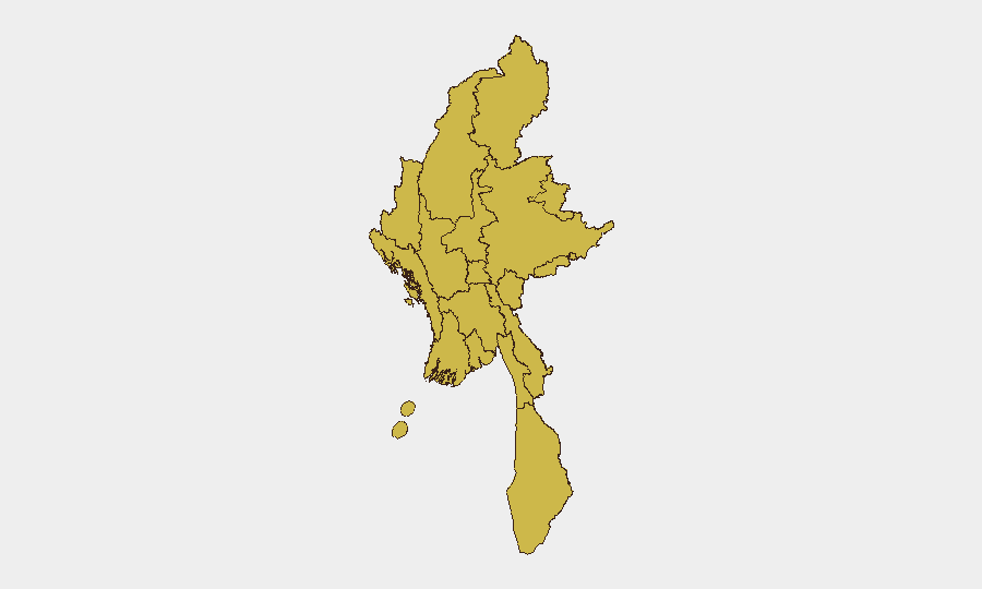
All twelve major administrative divisions show identical composite risk scores (67.6), reflecting widespread, persistent conflict distribution. Tanintharyi, Shan, Chin, Sagaing, and Kachin States—plus Wa State and the northern borderlands—remain primary theaters for armed-group operations, military air and ground activity, and civilian displacement. Yangon and Mandalay, despite urban concentration, score equally due to ongoing urban resistance activity and junta security operations. The parity in sub-national scores indicates that geographic "safe zones" do not exist; risk is genuinely distributed across the country, with variation occurring at township and neighborhood scale rather than state level.
How GeoBit Would Assist
Security and duty-of-care teams with staff or assets in Myanmar should deploy AOI (Area-of-Interest) Monitoring & Early Warning on specific facilities, transit routes, and residential neighborhoods to catch sub-state-level incidents (checkpoints, armed clashes, arrests) with 24–48 hour lag-time reduction. Intel Sweep (global event feeds, X/Telegram OSINT, multi-language search, entity extraction) provides real-time signal detection and actor-network mapping to track resistance, militia, and junta faction positioning. GIS & Spatial Analysis combined with Battle Mapping should be applied to Rakhine, Shan, and Chin State to correlate recent airstrike and ground-operation activity with asset locations and evacuation planning.
7-Day Outlook
No near-term ceasefire or major military reposition is indicated. Monsoon-season flooding will likely compound displacement and humanitarian need, particularly in delta regions (Ayeyarwady, Yangon periphery) and northern highlands. Continued low-level diplomatic incidents and public positioning toward China, Taiwan, and ASEAN suggest external pressure but no imminent third-party intervention. Risk trajectory remains static at elevated baseline.
Highest-Risk Areas — Ranked
| # | State / Region | Risk |
|---|---|---|
| 1 | Tanintharyi Region | 67.6 |
| 2 | Shan State | 67.6 |
| 3 | Chin | 67.6 |
| 4 | Sagaing Region | 67.6 |
| 5 | Kachin State | 67.6 |
| 6 | Wa State (Northern Region) | 67.6 |
| 7 | Magway | 67.6 |
| 8 | Mandalay | 67.6 |
| 9 | Rakhine | 67.6 |
| 10 | Ayeyarwady | 67.6 |
| 11 | Yangon | 67.6 |
| 12 | Naypyitaw Union Territory | 67.6 |
Sources
Previous Daily Briefs
A new Myanmar brief is written every day — each with its own risk map and downloadable CSV. Here's the last week; use the calendar to go further back.
📅 Browse every day by calendar →
Highlighted days have a brief. Tap a day for that day's map & analysis, or “csv” for that day's dataset ($5).
Atlas — our AI intelligence desk — emails them this snapshot personally. Nothing else, no list.