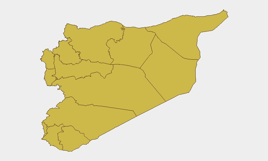
Situation Summary
Syria remains the 9th highest-threat country globally, driven by an active multi-sided civil conflict now in its fifteenth year. Sub-national risk is heavily concentrated in Damascus and the coastal/northern governorates, with Israeli military incursions in the south and continued counterterrorism operations against ISIS cells creating acute localized instability. The past 72 hours have seen escalation in Israeli-Syrian military activity, internal security operations, and regional diplomatic tension, with no clear de-escalation pathway in the immediate term.
Key Developments
- Quneitra Governorate (southern Syria), 26–29 July: Israeli military conducted ground incursions including bulldozer deployment into Al-Rafid village and checkpoint establishment at Al-Ardah; Syrian state media and regional sources reported shelling in the area. This marks a significant uptick in cross-border military activity in the Golan buffer zone.
- Latakia Province countryside (Jableh area), 29 July: Syrian security forces killed a suspect linked to March 2025 coastal attacks in an ambush near Falsqo village; a second suspect was killed in subsequent firefight. Operation suggests coordinated counterterrorism momentum but also indicates residual threat networks remain active.
- Aleppo City and al-Bab, 29 July: Security forces arrested multiple ISIS-affiliated operatives and dismantled active cells. Arrests underscore continued ISIS presence in northern Syria and ongoing state security sweeps.
- Damascus, 29 July: Trial proceedings opened for detainee Wassim al-Assad; minimal additional detail available from state media. Internal justice proceedings continue amid broader instability.
- Syria–Turkey messaging, 30 July: Public statements from Syrian officials regarding Turkey; context and substance unclear from available reporting, but signals continued interstate friction unresolved since 2026 Q2.
- UNSC/UN Engagement, 27 July: UN Secretary-General Guterres issued threat statement against Syria, likely related to compliance issues or humanitarian access. Indicates continued international pressure on Damascus.
Highest-Risk Areas
Damascus Governorate significantly outpaces other regions (96.6 vs. 67.5 average), reflecting capital-city concentration of state security apparatus, political decision-making, and armed-group targeting. Coastal governorates (Latakia, Tartus) and the northern tier (Aleppo, Idleb, Hama) carry elevated and near-uniform risk (66.6–67.5), driven by overlapping Turkish military presence, ISIS remnants, and fault lines between state and non-state armed actors. The Golan/southern buffer zones (Quneitra, Dar'a) are increasingly volatile due to Israeli military activity and weak state control, making predictability low for civilians and corporate operations in those areas.
How GeoBit Would Assist
Security teams with personnel or assets in Syria should employ AOI Monitoring & Early Warning to track Damascus and coastal governorates for escalation signals; OSINT fusion and multi-language event feeds to disambiguate competing narratives from state, regional, and opposition sources; and Conflict & Military battle mapping to assess Israeli-Syrian military positioning and predict flashpoint zones. Real-time Routing & Network Analysis tools enable duty-of-care teams to identify safe transit corridors and alternative supply routes around active conflict zones.
7-Day Outlook
Israeli-Syrian military tension is likely to persist or incrementally worsen absent diplomatic intervention; the Golan zone should be treated as high-volatility. Counterterrorism operations will continue in northern and coastal areas, creating localized security disruptions. No major political shift is imminent, but accumulating military incidents carry risk of unintended escalation.
Highest-Risk Areas — Ranked
| # | State / Region | Risk |
|---|---|---|
| 1 | Damascus Governorate | 96.6 |
| 2 | Lattakia Governorate | 67.5 |
| 3 | Aleppo Governorate | 67.5 |
| 4 | Tartus Governorate | 66.6 |
| 5 | UNDOF | 66.6 |
| 6 | Al-Quneitra Governorate | 66.6 |
| 7 | Dar'a Governorate | 66.6 |
| 8 | Idleb Governorate | 66.6 |
| 9 | Hama Governorate | 66.6 |
| 10 | Ar-Raqqa Governorate | 66.6 |
| 11 | Homs Governorate | 66.6 |
| 12 | Rif Dimashq Governorate | 66.6 |
Sources
Previous Daily Briefs
A new Syria brief is written every day — each with its own risk map and downloadable CSV. Here's the last week; use the calendar to go further back.
📅 Browse every day by calendar →
Highlighted days have a brief. Tap a day for that day's map & analysis, or “csv” for that day's dataset ($5).
Atlas — our AI intelligence desk — emails them this snapshot personally. Nothing else, no list.