Situation Summary
Canada's composite threat environment remains moderate (rank #100 globally, score 10/100) but is concentrated in Ontario, which accounts for a disproportionate share of tracked security events. Recent activity signals include small-arms combat in Toronto, diplomatic facility attack, civil disapproval actions, and law enforcement investigations. The threat trajectory is stable but localized, with Ontario's risk score (31.4) substantially exceeding all other provinces.
Key Developments
- Toronto, Ontario — 2026-08-03 (early morning): U.S. Consulate sustained gunfire damage; Toronto Police Service located shell casings and confirmed building impact. No injuries reported. This marks a continuation of targeting against the same diplomatic facility.
- Toronto, Ontario — 2026-08-03: Small-arms combat incident reported; police investigation underway. Specific location and casualty status require confirmation from law enforcement sources.
- Toronto, Ontario — 2026-08-01: Civil disapproval action recorded with reference to Palestine-related messaging; separate disapproval event involving presidential statements and airline operations also noted.
- Alberta & Manitoba — 2026-08-01: Rejection and disapproval actions reported; specific operational context not yet clarified in available signals.
- British Columbia (Fraser Canyon vicinity) — recent (exact date unconfirmed): Active wildfires near Boston Bar destroyed resort infrastructure; fire spread ongoing. Air quality and evacuation risk elevated in affected corridors.
- Saskatchewan (Weyburn area) — recent (exact date unconfirmed): Agricultural sprayer aircraft crashed into electrical infrastructure; pilot sustained serious injuries and hospitalized.
- Ontario (west of Ottawa) — recent (exact date unconfirmed): Fixed-wing aircraft accident with confirmed fatality.
Highest-Risk Areas
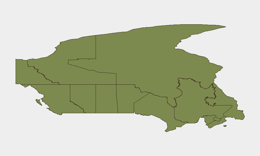
Ontario dominates the Canadian threat landscape, with a composite risk score of 31.4—more than three times higher than British Columbia (9.8) or Quebec (9.3). Toronto specifically has generated six of the last seven tracked events, including armed engagement, diplomatic targeting, and civil unrest indicators. Secondary concerns exist in British Columbia (wildfire, infrastructure vulnerability) and Alberta (civil disapproval actions). All other provinces remain at or below baseline risk thresholds, suggesting threat concentration rather than diffuse national instability.
How GeoBit Would Assist
Organizations with personnel or assets in Ontario should employ AOI Monitoring & Early Warning on high-visibility locations (diplomatic compounds, transportation hubs, government facilities) to detect emerging protest or confrontation signals in real time. Network & Actor Analysis combined with X/Twitter & Telegram OSINT would identify organized movements, messaging, and planning related to the Palestine-linked disapproval activity and any escalation intent. GIS & Spatial Analysis linked to wildfire and aviation incident data provides actionable routing alternatives and evacuation corridor assessment for BC and Saskatchewan operations.
7-Day Outlook
Toronto's threat trajectory remains elevated for the next week, with ongoing police investigation into small-arms incidents and potential for further civil action around geopolitical messaging. Environmental hazards (wildfires in BC, aviation risk) persist but are not expected to escalate. Corporate security teams should maintain heightened situational awareness in Ontario while continuing standard monitoring in secondary-risk provinces; no indication of national systemic instability or cascading events is present at this time.
Highest-Risk Areas — Ranked
| # | State / Region | Risk |
|---|---|---|
| 1 | Ontario | 31.4 |
| 2 | British Columbia | 9.8 |
| 3 | Quebec | 9.3 |
| 4 | Alberta | 7 |
| 5 | Nunavut | 4.3 |
| 6 | Newfoundland and Labrador | 4.3 |
| 7 | Manitoba | 3.7 |
| 8 | Nova Scotia | 1.8 |
| 9 | Yukon | 1.4 |
| 10 | Northwest Territories | 1.4 |
| 11 | Saskatchewan | 1.4 |
| 12 | New Brunswick | 1.4 |
Sources
Previous Daily Briefs
A new Canada brief is written every day — each with its own risk map and downloadable CSV. Here's the last week; use the calendar to go further back.
📅 Browse every day by calendar →
Highlighted days have a brief. Tap a day for that day's map & analysis, or “csv” for that day's dataset ($5).
Atlas — our AI intelligence desk — emails them this snapshot personally. Nothing else, no list.