Situation Summary
Central African Republic remains classified as #30 globally in composite threat (score 71), with no verified security incidents reported in the last 24–48 hours (31 July–1 August 2026). However, the country's underlying risk profile remains elevated due to fragmented armed groups, cross-border dynamics, and weak state capacity; recent developments—including late-June attacks on Am-Dafok in Vakaga and ongoing militia activity in southeastern prefectures—underscore persistent vulnerabilities despite the absence of reported current-window incidents. The renewal of UN sanctions on armed groups (29 July) may influence group behavior and external support networks in coming weeks.
Key Developments
No credible, time-stamped incidents have been reported in Central African Republic in the last 24–48 hours from institutional feeds (MINUSCA, UN, OSAC), news sources, or open web research. Current reporting carries a lag of several days to weeks; the most recent publicly available developments are:
- Am-Dafok, Vakaga (30 June–2 July): Armed attack on 30 June followed by FACA/MINUSCA response; authorities reported situation "under control" by 2 July but displacement and cross-border incursions ongoing.
- Vakaga border zone (late June–July): Sustained cross-border armed activity from Sudan, with civilian targeting and displacement; UN/MINUSCA deployed reinforcements and activated crisis information-sharing cells.
- UN Security Council Resolution 2827 (29 July): Unanimous extension of asset freezes, travel bans, and arms embargo on CAR armed groups and individuals through 31 July 2027; sanctions panel of experts mandate renewed.
- Haut-Mbomou/Mbomou (ongoing into mid-2026): AAKG militia attacks and abductions documented; MINUSCA human-rights missions active since early 2026.
Highest-Risk Areas
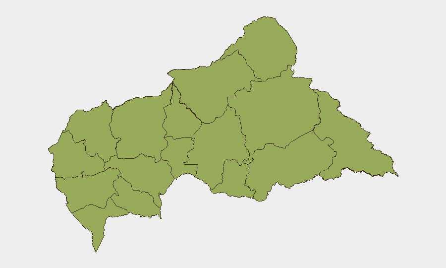
All 12 sub-national prefectures currently register identical composite risk scores (49.8), indicating an evenly distributed threat landscape rather than isolated hotspots. However, operational priorities should focus on Vakaga (Sudan border, recent cross-border incursions, displaced populations), Haut-Mbomou and Mbomou (southeastern AAKG militia activity and abductions), and Bamingui-Bangoran (northern armed-group presence). Peripheral prefectures collectively drive national risk; the absence of differential scores reflects CAR's decentralized conflict ecology, where multiple armed factions operate across fluid territorial boundaries rather than in concentrated zones.
How GeoBit Would Assist
Security teams operating in Central African Republic should deploy AOI Monitoring & Early Warning on Vakaga border crossings and Haut-Mbomou/Mbomou displacement corridors to detect militia movement patterns with advance notice; pair this with multi-language OSINT feeds and X/Telegram OSINT to track armed-group communications and leadership changes following the 29 July sanctions renewal. Routing & Network Analysis capabilities enable duty-of-care teams to plan movement between Bangui and field sites using real-time corridor security assessments and alternative routes if primary roads encounter armed activity.
7-Day Outlook
The renewal of UN sanctions on 29 July may prompt short-term consolidation or fragmentation of armed-group networks as external support pathways narrow; this could manifest as localized territorial repositioning or supply-route shifts rather than large-scale escalation. Vakaga and southeastern prefectures remain the highest-probability zones for reported incidents within seven days. U.S. and EU travel advisories continue to classify CAR as "do not travel"; organizations with personnel or assets in-country should maintain elevated situational awareness and contingency protocols.
Highest-Risk Areas — Ranked
| # | State / Region | Risk |
|---|---|---|
| 1 | Bamingui-Bangoran | 49.8 |
| 2 | Vakaga | 49.8 |
| 3 | Haute-Kotto | 49.8 |
| 4 | Haut-Mbomou | 49.8 |
| 5 | Mbomou | 49.8 |
| 6 | Nana-Mambéré | 49.8 |
| 7 | Ouham-Pendé | 49.8 |
| 8 | Mambéré-Kadéï | 49.8 |
| 9 | Sangha-Mbaéré | 49.8 |
| 10 | Ouham | 49.8 |
| 11 | Nana-Grébizi | 49.8 |
| 12 | Kémo | 49.8 |
Sources
Previous Daily Briefs
A new Central African Republic brief is written every day — each with its own risk map and downloadable CSV. Here's the last week; use the calendar to go further back.
📅 Browse every day by calendar →
Highlighted days have a brief. Tap a day for that day's map & analysis, or “csv” for that day's dataset ($5).
Atlas — our AI intelligence desk — emails them this snapshot personally. Nothing else, no list.