Situation Summary
China's overall security posture remains stable with no major acute domestic unrest, civil disorder, or terror activity in the last 24–48 hours. However, recent activity reflects concurrent pressures across three domains: industrial safety (major factory fire in Fujian), natural disasters (landslides and severe weather affecting multiple provinces), and military/strategic operations (submarine missile test, South China Sea patrols, and maritime confrontation with Japan). These incidents are geographically dispersed and sectoral rather than indicative of systemic instability, but corporate and logistics operations face near-term disruption in affected zones.
Key Developments
- Jinjiang, Fujian Province – shoe factory fire (Thursday, late July). A fire at an industrial facility killed 28 people, drawing high-level government intervention and search-and-rescue mobilization. Factory operations and local emergency services remain stretched; supply-chain exposure for footwear and light-manufacturing supply chains in Fujian.
- Western Gansu Province – landslide (Tuesday, late July). Sixteen people buried in a mountainous county; ongoing rescue operations. Roads and rural infrastructure at risk; localized transportation delays likely.
- Hubei Province – severe weather (Tuesday, late July). Thunderstorms caused at least 8 fatalities; forecasters warn of torrential rain affecting ~200 million people across multiple regions. Significant flood risk for transport networks, power infrastructure, and rural areas through the forecast window.
- South China Sea – PLA air and naval patrols (last 48 hours, ongoing). Coordinated exercises by Southern Theater Command emphasizing "territorial sovereignty and maritime rights." Standard posture activity but relevant to commercial shipping and aviation transiting disputed waters.
- East China Sea – China–Japan coast guard incident near Senkaku/Chiwei Yu (Tuesday, late July). Conflicting accounts of Chinese expulsion of Japanese fishing vessel. Heightened but localized maritime tension; minor risk to vessels in the immediate area.
- Southern coastal waters – submarine-launched strategic missile test (Monday, late July). China test-fired a ballistic missile from a nuclear-powered submarine into the Pacific. Chinese sources note advance notification; international criticism from Japan, Australia, New Zealand. Regional military/geopolitical signal; no domestic security impact.
- Nationwide – cybersecurity and data-exposure warnings (recent days). Authorities warning of foreign-linked mobile apps and check-in features potentially exposing sensitive location data near restricted facilities; Hong Kong corporate sector experienced cyberattack affecting ~1 million individuals. Elevated corporate data-security risk across Greater China.
Highest-Risk Areas
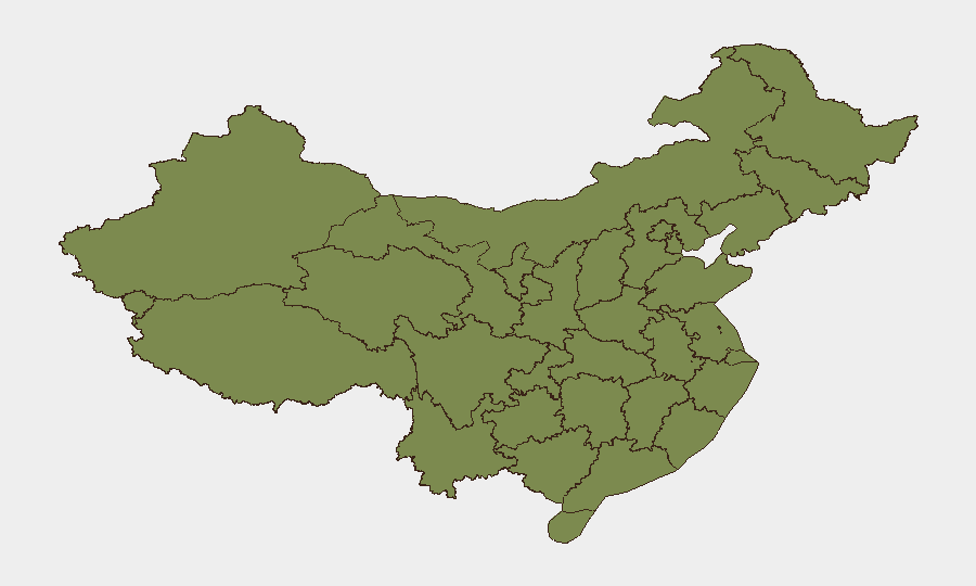
Beijing's composite risk score (32.5) is substantially higher than other regions, driven by central-government activity, diplomatic incidents, and cyber/information operations typical of the capital. Guangdong, Shanghai, and Jiangsu follow, reflecting large urban populations, manufacturing concentration, and maritime exposure. Fujian's ranking reflects the current factory-fire incident and industrial-base vulnerability; Gansu and Hubei face elevated natural-disaster risk from ongoing severe weather. No region exhibits signs of civil unrest or political instability; risk is primarily operational, logistical, and environmental.
How GeoBit Would Assist
Teams should employ AOI Monitoring & Early Warning on Fujian Province (factory and supply-chain hubs), Hubei and Gansu (flood-risk zones), and South China Sea transit corridors to detect escalation in disasters or maritime incidents. Cyber threat intelligence and entity extraction on foreign-linked apps and data-exposure alerts will clarify exposure scope for personnel and corporate networks. Routing & Network Analysis can map alternative logistics and travel paths avoiding weather-affected areas and factory disruption zones.
7-Day Outlook
Natural disasters (heavy rain, flooding) pose the highest near-term operational risk, with Hubei, Gansu, and downstream river provinces facing 5–7 days of hazardous conditions. Factory recovery and supply-chain normalization in Fujian will likely extend 1–2 weeks. Maritime and military activity (South China Sea, Japan tensions) will remain routine posture operations absent fresh escalation; no acute threat to domestic stability is forecast.
Highest-Risk Areas — Ranked
| # | State / Region | Risk |
|---|---|---|
| 1 | Beijing | 32.5 |
| 2 | Guangdong Province | 11.5 |
| 3 | Shanghai | 11.3 |
| 4 | Jiangsu | 10.2 |
| 5 | Zhejiang | 5.2 |
| 6 | Jiangxi | 4.8 |
| 7 | Hubei | 4.4 |
| 8 | Tibet | 3.9 |
| 9 | Fujian | 3 |
| 10 | Gansu | 2.8 |
| 11 | Henan | 2.8 |
| 12 | Guangxi | 2.7 |
Sources
Previous Daily Briefs
A new China brief is written every day — each with its own risk map and downloadable CSV. Here's the last week; use the calendar to go further back.
📅 Browse every day by calendar →
Highlighted days have a brief. Tap a day for that day's map & analysis, or “csv” for that day's dataset ($5).
Atlas — our AI intelligence desk — emails them this snapshot personally. Nothing else, no list.