Situation Summary
Myanmar remains in active civil conflict following the February 2021 coup, with armed opposition to the ruling junta concentrated in border regions and ethnic-minority territories. As of 26 July 2026, the country ranks #9 globally for composite security threat (score 96), driven by ongoing multi-front armed engagements, civil unrest, and displacement. All sub-national regions carry elevated and uniform risk (67.1), reflecting conflict diffusion across the country rather than geographic containment. Near-term trajectory remains unstable, with no indication of negotiated settlement or military stalemate.
Key Developments
- Kale–Khampat–Tamu corridor, Sagaing Region (24–25 July): The Tamu Emergency Administration Committee issued urgent travel warnings citing heavy artillery shelling, airstrikes, and active ground engagements along the Asian Highway route. Civilian relocation has been called for; road access remains restricted.
- Yaw Region, Magway/Chin/Rakhine border (24–25 July): Military operations and airstrikes targeting supply routes have displaced over 10,000 residents from more than 30 villages. Ongoing displacement and road insecurity persist; no indication of operations concluding.
- Yangon downtown—Martyrs' Mausoleum and Sule Pagoda (24 July): Security operations on the 79th Martyrs' Day resulted in detention and phone searches of at least five youths. Heightened state security presence in central Yangon reflects political tension around commemorative dates.
- Lahe Township, Naga Self-Administered Zone, Sagaing (24 July): Civil organizations and residents boycotted a regime-appointed official's welcoming event in protest against forced military recruitment of youth in Lahe, Khamti, and Leshi townships. Localized civil resistance to conscription continues.
- Western Madaya Township, Mandalay Region (24–25 July): Ongoing clashes and "military friction" near Thea In and Shin Hla Taung villages persist. Military presence and low-intensity engagements continue to restrict civilian movement.
- Rakhine State, Arakan Army–controlled areas (24–25 July): Health authorities under the United League of Arakan are providing free measles-rubella vaccinations to approximately 80,000 children under five. This indicates continued civilian needs and infrastructure strain amid conflict.
- Myanmar vs. China and Taiwan (23 July): Official statements conveyed threats toward both countries, reflecting diplomatic friction. Myanmar vs. ASEAN public statements (24 July) suggest continued regional diplomatic friction.
Highest-Risk Areas
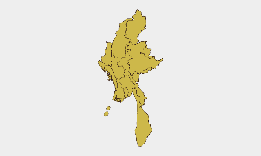
All twelve sub-national regions carry identical risk scores (67.1), indicating conflict and instability are no longer geographically bounded. However, the northern and eastern border zones—Shan, Kachin, Sagaing, Tanintharyi, and Chin—historically drive active armed operations and armed-group control. Sagaing and the Yaw region currently show the most acute near-term security events (displacement, artillery, airstrikes). Yangon and Naypyitaw, despite equal risk scoring, face primarily state security and civil-unrest risk rather than armed-group activity, reflecting the political character of control in the two largest urban centers.
How GeoBit Would Assist
Corporate teams should deploy AOI Monitoring & Early Warning on specific corridors (Kale–Khampat–Tamu, Yaw region routes) and urban nodes (Yangon downtown, Mandalay) for persistent threat alerting. Routing & Network Analysis can identify alternative supply and personnel routes avoiding active conflict zones in real time. Conflict & Military battle mapping and force-structure tracking, combined with satellite imagery analysis, provide early indication of troop repositioning or airfield activity that may signal escalation.
7-Day Outlook
No de-escalation signals are evident; armed operations and displacement in Sagaing and the Yaw region are likely to continue or intensify. State security operations in Yangon may spike around political dates. Road closures and restricted movement in northern and eastern corridors should be assumed persistent; corporate logistics and personnel rotation planning must account for multi-week delays or rerouting.
Highest-Risk Areas — Ranked
| # | State / Region | Risk |
|---|---|---|
| 1 | Tanintharyi Region | 67.1 |
| 2 | Shan State | 67.1 |
| 3 | Chin | 67.1 |
| 4 | Sagaing Region | 67.1 |
| 5 | Kachin State | 67.1 |
| 6 | Wa State (Northern Region) | 67.1 |
| 7 | Magway | 67.1 |
| 8 | Mandalay | 67.1 |
| 9 | Rakhine | 67.1 |
| 10 | Ayeyarwady | 67.1 |
| 11 | Yangon | 67.1 |
| 12 | Naypyitaw Union Territory | 67.1 |
Sources
Previous Daily Briefs
A new Myanmar brief is written every day — each with its own risk map and downloadable CSV. Here's the last week; use the calendar to go further back.
📅 Browse every day by calendar →
Highlighted days have a brief. Tap a day for that day's map & analysis, or “csv” for that day's dataset ($5).
Atlas — our AI intelligence desk — emails them this snapshot personally. Nothing else, no list.