Situation Summary
Central African Republic remains at moderate global threat ranking (#29 globally, composite score 65) with structurally elevated risk concentrated in border regions and areas with active armed-group presence. No major security incidents have been confirmed in open sources for the past 24–48 hours; however, the humanitarian situation reflects a "recent increase in armed violence" displacing over 19,000 people across multiple prefectures. The UN Security Council's July 29–30 extension of the CAR sanctions regime and Panel of Experts mandate underscores international focus on non-state armed groups and transnational arms networks as persistent drivers of instability. Security posture remains tense but not in acute crisis phase.
Key Developments
- UN Security Council Resolution 2827 adoption (New York, July 29–30, 2026): Unanimous extension of CAR sanctions regime targeting armed groups and designated individuals through 31 July 2027; Panel of Experts mandate extended to 31 August 2027. Signals sustained diplomatic pressure on armed actors and cross-border networks, though does not indicate new ground-level incidents.
- MINUSCA/FACA reinforced presence in Am-Dafock (Vakaga prefecture, ongoing post-30 June): Joint crisis-management cell and additional military deployments remain in place following June 30 armed attacks that displaced thousands. Open sources do not confirm new incidents in this location within the past 24–48 hours, but sustained deployment indicates operational concern.
- Data gap: No corroborated discrete security incidents in CAR (Aug 1–2, 2026): Professional security and conflict-monitoring feeds note limited open-source reporting for incident-level events across Central Africa in the past 48 hours. This reflects reporting gaps in conflict monitoring rather than confirmed absence of activity; corporate teams should account for potential blind spots in real-time incident awareness.
- Humanitarian operations ongoing (multi-prefecture, timing mid-July to early August): NGO and UN sources document emergency medical relief and displacement response related to recent armed violence, with over 19,000 people displaced. Precise incident dates and locations are not provided in available reporting, limiting tactical specificity.
Highest-Risk Areas
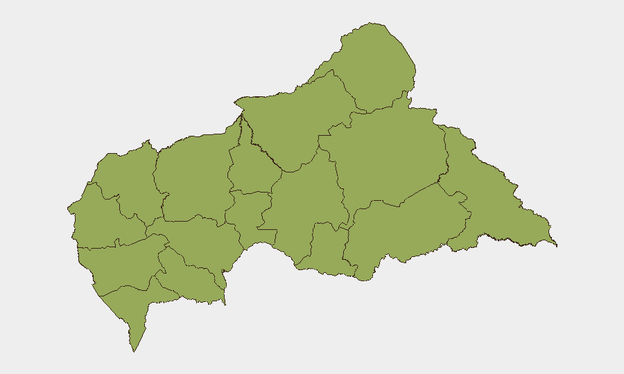
All twelve prefectures rank equally at composite risk 45.2, indicating broad geographic distribution of threat rather than a single critical hotspot. Eastern border regions—particularly Vakaga, Haut-Mbomou, and Mbomou—carry elevated risk due to proximity to unstable areas in South Sudan and Democratic Republic of Congo, as well as documented armed-group presence and trafficking networks. Northern and western prefectures (Bamingui-Bangoran, Ouham-Pendé, Nana-Mambéré) face similar structural vulnerabilities related to cross-border arms flows and militia activity. Organizations with assets or personnel in any prefecture should maintain baseline threat awareness and supply-chain resilience; no single area can be treated as materially safer than others.
How GeoBit Would Assist
Security teams operating in CAR should employ AOI Monitoring & Early Warning on key installations, checkpoints, and supply routes in high-traffic prefectures to detect patterns of armed activity or checkpoint changes; Intel Sweep and multi-language OSINT fusion (including Telegram and regional sources) to bridge the current open-source reporting gap; and Network & Actor Analysis to track armed-group leadership, designations, and cross-border supply networks flagged in the sanctions regime. Routing & Network Analysis can identify alternative transport corridors and monitor humanitarian access in real time.
7-Day Outlook
No acute escalation is anticipated in the next seven days absent major political or electoral developments. Structural risk remains elevated, and reporting gaps mean ground-level activity may not appear in open sources immediately. Organizations should maintain current posture, monitor diplomatic announcements, and prepare contingency plans for rapid movement of personnel or assets if localized incidents spike.
Highest-Risk Areas — Ranked
| # | State / Region | Risk |
|---|---|---|
| 1 | Bamingui-Bangoran | 45.2 |
| 2 | Vakaga | 45.2 |
| 3 | Haute-Kotto | 45.2 |
| 4 | Haut-Mbomou | 45.2 |
| 5 | Mbomou | 45.2 |
| 6 | Nana-Mambéré | 45.2 |
| 7 | Ouham-Pendé | 45.2 |
| 8 | Mambéré-Kadéï | 45.2 |
| 9 | Sangha-Mbaéré | 45.2 |
| 10 | Ouham | 45.2 |
| 11 | Nana-Grébizi | 45.2 |
| 12 | Kémo | 45.2 |
Sources
Previous Daily Briefs
A new Central African Republic brief is written every day — each with its own risk map and downloadable CSV. Here's the last week; use the calendar to go further back.
📅 Browse every day by calendar →
Highlighted days have a brief. Tap a day for that day's map & analysis, or “csv” for that day's dataset ($5).
Atlas — our AI intelligence desk — emails them this snapshot personally. Nothing else, no list.