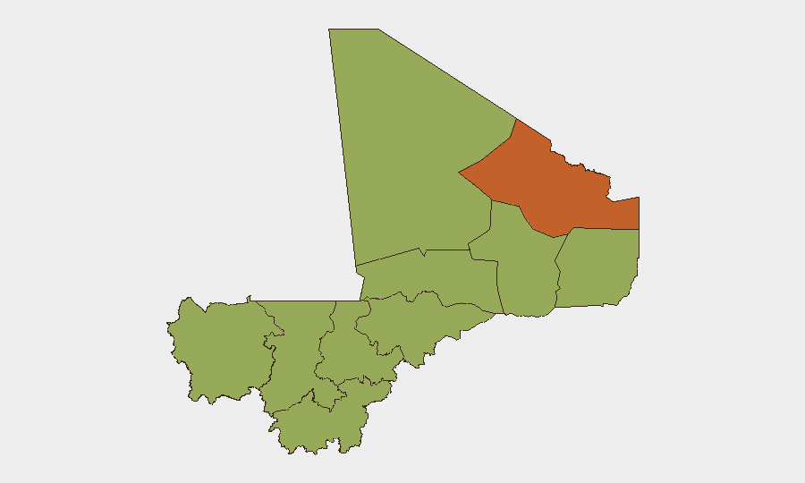
Situation Summary
Mali remains the #17 global threat jurisdiction (composite score 76) with insurgency as the primary driver and 42 tracked threat events under active monitoring. A quiet period in verified incident reporting has characterized the past 24–48 hours, with no independently confirmed attacks, clashes, major arrests, or infrastructure damage reported across northern and central regions. However, this absence of newly reported incidents does not reflect a reduction in underlying threat; persistent terrorism, organized crime, and kidnapping risks remain endemic, and national-level travel advisories (Level 4 "Do Not Travel") continue to reflect the broader structural security crisis.
Key Developments
- 2026-08-02 · Bamako (national) – Malian authorities issued public statements on military operations and conducted arrest/detention activities; specific operational details remain limited in open reporting.
- 2026-08-02 · Bamako (national) – Diplomatic friction surfaced between Mali and Ukraine, with Mali reducing bilateral relations; underlying rationale not yet clarified in independent sources.
- 2026-08-01 · Nationwide – Rights groups issued disapproval statements regarding reported Russian activities, signaling external scrutiny of foreign security partnerships.
- 2026-08-01 · Bamako (national) – Malian military engaged in conventional operations against rebel/insurgent forces; scale, location, and outcome pending further verification.
- No additional independently verified incident-level events (attacks, clashes, kidnappings, infrastructure damage) were confirmed in Mali during 2026-07-31 to 2026-08-02 across monitored high-risk zones including Timbuktu, Ménaka, Gao, Mopti, Koulikoro, or Kidal.
Highest-Risk Areas
Bamako (risk 83) remains the single highest-risk location, driven by convergence of political instability, crime, and potential protest activity. The northern tier—Kidal (74.2), Gao, Timbuktu, and Ménaka (each 53+)—reflects active and persistent insurgent presence, AQIM and affiliated franchise operations, and minimal state control. Koulikoro (53.7), Mopti (53.2), and Ségou (53) face elevated risk from mobile insurgent cells and criminal networks operating along transportation corridors. Central and southern regions, while ranked lower, remain subject to spillover violence and banditry, particularly Kayes and Sikasso (53).
How GeoBit Would Assist
Corporate security teams with personnel or assets in Mali should employ AOI (Area-of-Interest) Monitoring & Early Warning to establish persistent watch on high-risk zones (Bamako, Kidal, Mopti) with automated alerting on incident confirmation. Battle Mapping and Force Structure tracking enable real-time visibility into military and insurgent positioning, particularly in the Sahel corridor. Multi-language OSINT feeds (X, Telegram, local radio SIGINT) and Network & Actor Analysis provide early signals of organizational changes, leadership movements, or operational tempo shifts before incidents materialize. Routing & Network Analysis supports duty-of-care teams in identifying safe transit corridors and alternative logistics pathways during heightened activity periods.
7-Day Outlook
Near-term trajectory suggests continued low incident reporting but sustained underlying threat posture. Diplomatic shifts (Mali–Ukraine relations) and intensified arrest/detention activity may indicate internal security consolidation or political repositioning, warranting close monitoring for secondary spillover effects. Teams should maintain heightened alertness around transportation corridors and maintain updated contingency protocols, as the current quiet period does not guarantee sustained stability.
Highest-Risk Areas — Ranked
| # | State / Region | Risk |
|---|---|---|
| 1 | Bamako | 83 |
| 2 | Kidal | 74.2 |
| 3 | Koulikoro | 53.7 |
| 4 | Mopti | 53.2 |
| 5 | Ménaka | 53 |
| 6 | Kayes | 53 |
| 7 | Taoudénit Region | 53 |
| 8 | Gao | 53 |
| 9 | Ségou Region | 53 |
| 10 | Sikasso Region | 53 |
| 11 | Timbuktu | 53 |
Sources
Previous Daily Briefs
A new Mali brief is written every day — each with its own risk map and downloadable CSV. Here's the last week; use the calendar to go further back.
📅 Browse every day by calendar →
Highlighted days have a brief. Tap a day for that day's map & analysis, or “csv” for that day's dataset ($5).
Atlas — our AI intelligence desk — emails them this snapshot personally. Nothing else, no list.