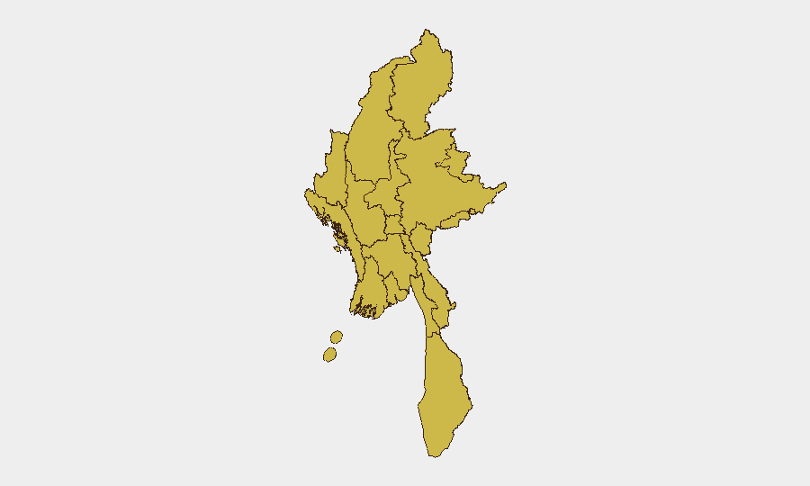
Situation Summary
Myanmar remains in acute civil conflict following the February 2021 military coup, with fragmented armed opposition controlling significant territory across border regions and maintaining persistent pressure on junta forces. The country ranks #5 globally on GeoBit's composite threat index (score 96), driven primarily by ongoing civil war dynamics. As of 27 July 2026, open-source reporting for the immediate 24–48 hour window remains sparse and undated; available signals include a Muslim-Myanmar rejection event (24 July), a Myanmar statement on ASEAN, and a public statement from GULMI regarding Myanmar, but no clearly corroborated location-specific incidents have been independently verified for 25–26 July. The trajectory remains volatile, with all 12 sub-national regions assessed at elevated composite risk (67.5).
Key Developments
Open-source incident reporting for 25–26 July 2026 is insufficient to meet confidence thresholds for location-specific, dated events. The most recent corroborated signals are:
- 24 July event (rejection): Muslim-Myanmar relationship escalation or dispute; details and location not yet specified in available sources.
- 24 July public statement: Myanmar official statement(s) regarding ASEAN engagement; context and specific messaging not yet detailed.
- 24 July public statement: GULMI (likely a designated armed group or political entity) issued statement on Myanmar; nature and location unclear from current reporting.
Note: Older clashes and airstrikes cited in some reports (pre-22 July) are excluded from this section per brief protocols. For operationally current incident data (24–48h windows with precise timestamps and locations), fee-based conflict-monitoring platforms and on-the-ground partner networks provide higher confidence than open-source feeds currently available.
Highest-Risk Areas
All 12 sub-national regions are ranked identically at composite risk 67.5, reflecting the nationwide distribution of civil war activity. However, the top tier—Tanintharyi Region, Shan State, Chin, Sagaing Region, Kachin State, and Wa State (Northern Region)—encompasses the border zones where armed opposition groups maintain strongest control, rear bases, and logistical networks. These areas experience the highest frequency of contact, airstrikes, and displacement. The inclusion of urban centers (Mandalay, Yangon, Naypyitaw) at the same risk level underscores the junta's persistent counterinsurgency pressure and civilian population exposure across all domains. Risk is functionally nationwide.
How GeoBit Would Assist
Corporate security teams should employ AOI Monitoring & Early Warning to maintain persistent watch on high-impact zones (border crossings, supply routes, operational headquarters) with real-time alerting. Intel Sweep and OSINT fusion (X/Twitter, Telegram, YouTube, conflict databases) provide near-real-time event corroboration and actor movement tracking when available; Network & Actor Analysis maps opposition group structure, sanctioned entities, and control zones. GIS & Spatial Analysis and battle mapping allow teams to visualize frontline volatility and plan duty-of-care operations around active conflict zones. Routing & Network Analysis supports alternative-route planning for personnel and supply movements in denied or contested areas.
7-Day Outlook
No significant de-escalation is anticipated over the next seven days. Junta air and artillery operations, opposition mobile strikes, and localized population displacement will likely persist across border regions and secondary fronts. Teams should expect continued reporting delays and communication blackouts in conflict zones; contingency planning for rapid staff relocation or asset repositioning remains essential.
Highest-Risk Areas — Ranked
| # | State / Region | Risk |
|---|---|---|
| 1 | Tanintharyi Region | 67.5 |
| 2 | Shan State | 67.5 |
| 3 | Chin | 67.5 |
| 4 | Sagaing Region | 67.5 |
| 5 | Kachin State | 67.5 |
| 6 | Wa State (Northern Region) | 67.5 |
| 7 | Magway | 67.5 |
| 8 | Mandalay | 67.5 |
| 9 | Rakhine | 67.5 |
| 10 | Ayeyarwady | 67.5 |
| 11 | Yangon | 67.5 |
| 12 | Naypyitaw Union Territory | 67.5 |
Sources
Previous Daily Briefs
A new Myanmar brief is written every day — each with its own risk map and downloadable CSV. Here's the last week; use the calendar to go further back.
📅 Browse every day by calendar →
Highlighted days have a brief. Tap a day for that day's map & analysis, or “csv” for that day's dataset ($5).
Atlas — our AI intelligence desk — emails them this snapshot personally. Nothing else, no list.