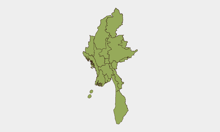
Situation Summary
Myanmar remains in active civil conflict with nationwide security fragmentation following the February 2021 military coup. The composite threat score of 82 places Myanmar at #13 globally, driven primarily by ongoing insurgency, military operations, and armed-group activity across multiple regions. Recent 24–48-hour reporting indicates sustained kinetic operations, including vehicle bombings, aerial strikes on civilian areas, and forced conscription, with no indication of de-escalation. All twelve sub-national administrative zones are assessed at equivalent elevated risk (57.5), reflecting the geographic distribution of conflict across the country.
Key Developments
- Myawaddy Township, Kayin State (27 July 2026): Vehicle bomb detonated near a former Karen National Army checkpoint at a rubber plantation, killing seven KNA members and injuring nine others; casualty figures pending independent verification.
- Monhla village, Sagaing Region (25 July 2026): Three military gyrocopters conducted bombing runs on civilian settlement, killing a 60-year-old woman and destroying homes, rice storage, and vehicles.
- Shwebo Township, Sagaing Region (25–26 July 2026): Following a drone attack on a military installation, indiscriminate artillery fire killed the daughter of a village administrator and injured two additional civilians.
- Kyin Htaung and Htein San villages, Magway Region (25–26 July 2026): Drone and suicide-drone strikes targeted two separate settlements; damage to civilian infrastructure recorded, no civilian casualties reported in preliminary accounts.
- Hpakant Township, Kachin State (25–26 July 2026): Roadside mine explosion injured two civilians on a travel route, indicating continued threat to transportation corridors.
- Nationwide forced recruitment (ongoing, announced 27 July 2026): Military Service Batch 27 conscription drive continuing across multiple regions, compounding human-rights risk and civilian instability.
- Labor movement suspension (27 July 2026): Confederation of Trade Unions Myanmar (STUM) announced indefinite operational suspension due to financial strain, reducing civil-society organizational capacity and protest infrastructure.
Highest-Risk Areas
All twelve sub-national zones are ranked identically (57.5), indicating systemic nationwide risk rather than isolated hotspots. However, Sagaing and Magway regions show the highest concentration of recent kinetic incidents in the 24–48-hour window, with multiple aerial and artillery attacks on civilian settlements. Kachin State, Kayin State, and Tanintharyi Region remain persistently exposed to armed-group activity and IED threats. The uniform risk ranking reflects the reality that conflict dynamics, military operations, and armed-group presence pervade Myanmar's geography; organizational and operational decisions regarding personnel and asset movement should treat all regions as active-conflict zones.
How GeoBit Would Assist
Teams managing personnel or assets in Myanmar should employ AOI Monitoring & Early Warning on high-traffic corridors (particularly Sagaing, Magway, and Kachin routes) to detect military movements, drone operations, and IED placement in near-real time. Conflict & Military battle mapping and force-structure tracking would clarify localized military and armed-group disposition, enabling targeted route planning. Routing & Network Analysis combined with Intel Sweep (cross-platform OSINT fusion on recent incidents and armed-group signaling) would support duty-of-care assessments for travel, evacuation triggers, and personnel accountability protocols.
7-Day Outlook
Kinetic activity is expected to persist at current or elevated levels across Sagaing, Magway, and eastern zones through early August. Forced conscription and labor-movement suspension will likely compound civilian grievances and supply-chain friction. No ceasefire signals, political negotiation, or military repositioning have been reported; trajectory remains toward sustained dispersed conflict and humanitarian strain.
Highest-Risk Areas — Ranked
| # | State / Region | Risk |
|---|---|---|
| 1 | Tanintharyi Region | 57.5 |
| 2 | Shan State | 57.5 |
| 3 | Chin | 57.5 |
| 4 | Sagaing Region | 57.5 |
| 5 | Kachin State | 57.5 |
| 6 | Wa State (Northern Region) | 57.5 |
| 7 | Magway | 57.5 |
| 8 | Mandalay | 57.5 |
| 9 | Rakhine | 57.5 |
| 10 | Ayeyarwady | 57.5 |
| 11 | Yangon | 57.5 |
| 12 | Naypyitaw Union Territory | 57.5 |
Sources
Previous Daily Briefs
A new Myanmar brief is written every day — each with its own risk map and downloadable CSV. Here's the last week; use the calendar to go further back.
📅 Browse every day by calendar →
Highlighted days have a brief. Tap a day for that day's map & analysis, or “csv” for that day's dataset ($5).
Atlas — our AI intelligence desk — emails them this snapshot personally. Nothing else, no list.