Situation Summary
Syria remains in the #9 global threat position (composite score 95) driven by ongoing civil conflict. The most recent event signals (31 July – 2 August) indicate escalating conventional military activity between Syria and Saudi Arabia, alongside Israeli threat posture toward residents and internal investigations in Damascus. Damascus Governorate carries the highest sub-national risk (96.8), but conflict pressure extends across northwestern, southern, and northeastern zones. The trajectory shows active military engagement rather than de-escalation, with no clear indicators of imminent cessation.
Key Developments
Open-source verification of specific incidents within the last 24–48 hours (1–2 August 2026) is currently insufficient. While GeoBit event signals record Syria–Saudi Arabia conventional military force exchanges and Damascus-linked investigations dated 31 July – 2 August, live web research does not corroborate clearly time-stamped incident details from that window. Undated "current" conflict markers on OSINT dashboards (e.g., reports of blasts in Damascus, attacks in Suwayda, Israeli incursions in Quneitra, and casualties in Aleppo) appear in standing situation summaries but lack publication or occurrence timestamps that would confirm 1–2 August occurrence. Syrian state media (SANA) and international outlets carry security reporting from June–July 2026, but no newly published incidents are clearly placed within the past 48 hours.
Recommendation: Security teams requiring verified 24–48h incident detail should cross-reference GeoBit alerts with internal field reports or direct OSINT feeds with explicit timestamps. Generic standing summaries cannot reliably serve duty-of-care documentation.
Highest-Risk Areas
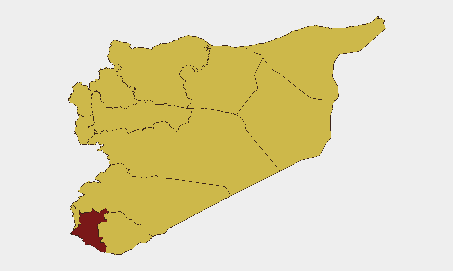
Damascus Governorate dominates the risk profile at 96.8, driven by capital-city concentration of state institutions, military command nodes, and civilian infrastructure. The second tier—Dar'a (82.3) and ten regions clustered at 66.8 (Idleb, Aleppo, Hama, Ar-Raqqa, Homs, Tartus, Lattakia, Al-Quneitra, UNDOF zone, and Rif Dimashq)—reflects active combat zones, cross-border tension, and Israeli-Syrian friction. Northwestern Syria (Idleb, Aleppo) and the south (Dar'a, Al-Quneitra) show sustained conventional military pressure; coastal areas (Tartus, Lattakia) remain elevated despite lower headline activity. The clustering of ten regions at identical risk scores suggests systemic conflict presence rather than localized hotspots.
How GeoBit Would Assist
Security teams with personnel or assets in Syria should deploy AOI Monitoring & Early Warning on high-risk governorates (Damascus, Dar'a, Idleb, Aleppo) to receive alert-based updates on new military activity or threat events. Battle Mapping and Force Structure tracking clarifies real-time position and capability of state, opposition, and Israeli forces to inform movement and facility security decisions. Routing & Network Analysis identifies alternative transport corridors when primary roads intersect conflict zones or checkpoints; combined with Satellite & Imagery Analysis, it supports asset location verification and perimeter assessment in unstable regions.
7-Day Outlook
Syria–Saudi conventional military tensions and ongoing Damascus-area investigation activity suggest elevated operational tempo through early August. No de-escalation catalysts are evident in the signal pattern. Duty-of-care teams should expect continued reporting of localized military engagement, security force activity, and cross-border posturing; the absolute risk to specific installations will depend on proximity to active zones and exposure to secondary effects (airstrikes, shelling, checkpoint disruption).
Highest-Risk Areas — Ranked
| # | State / Region | Risk |
|---|---|---|
| 1 | Damascus Governorate | 96.8 |
| 2 | Dar'a Governorate | 82.3 |
| 3 | Lattakia Governorate | 66.8 |
| 4 | Tartus Governorate | 66.8 |
| 5 | UNDOF | 66.8 |
| 6 | Al-Quneitra Governorate | 66.8 |
| 7 | Idleb Governorate | 66.8 |
| 8 | Aleppo Governorate | 66.8 |
| 9 | Hama Governorate | 66.8 |
| 10 | Ar-Raqqa Governorate | 66.8 |
| 11 | Homs Governorate | 66.8 |
| 12 | Rif Dimashq Governorate | 66.8 |
Sources
Previous Daily Briefs
A new Syria brief is written every day — each with its own risk map and downloadable CSV. Here's the last week; use the calendar to go further back.
📅 Browse every day by calendar →
Highlighted days have a brief. Tap a day for that day's map & analysis, or “csv” for that day's dataset ($5).
Atlas — our AI intelligence desk — emails them this snapshot personally. Nothing else, no list.