Situation Summary
Iran remains in active military conflict with the United States and coalition forces, characterized by sustained aerial strikes, missile exchanges, and maritime blockade activity. A near-total national internet blackout was confirmed on Wednesday, severely degrading situational awareness and business continuity across the country. Air defence activation over Tehran and widespread strikes on southern Iranian provinces within the last 24–48 hours confirm that kinetic operations continue despite a U.S. statement that strikes are "on hold." The security environment is volatile and unpredictable, with military activity capable of resuming on short notice.
Key Developments
- Near-total national internet blackout – nationwide Iran (Wednesday, 24–48h ago). NetBlocks reported Iran entered a near-total blackout following partial disruptions amid escalating military tensions. Impact extends to all communications, financial transactions, and safety coordination.
- Air defence activation over Tehran (Thursday, within 24–48h). Iranian state media reported air defence systems activated against "hostile targets" over the capital, confirming ongoing aerial threat and risk of strikes, debris, and secondary explosions.
- Widespread aerial attacks across southern Iran (Wednesday evening, within 24–48h). Iranian news agencies reported multiple airstrikes on southern provinces while Trump issued further threats and Iran's foreign minister pledged retaliation.
- IRGC reimposition of full Strait of Hormuz blockade (within last 24–48h cycle). The Islamic Revolutionary Guard Corps re-imposed a complete blockade, warning that vessels approaching the strait will be treated as hostile and targeted. Direct threat to commercial shipping and energy exports.
- U.S. naval blockade remains in full effect (current as of early Sunday). U.S. Department of Defense confirmed strikes are "on hold," but the naval blockade of Iranian ports persists. U.S. and Iran engaged in technical and political talks via Oman over Strait navigation.
- Thirteen consecutive nights of strikes on Iranian military targets (through hold period). U.S. Central Command detailed sustained operations to degrade Iran's anti-shipping and anti-air capabilities before placing strikes on hold.
- Iranian missile and drone launches against U.S. and regional targets (ongoing within conflict cycle). Iran and allied forces claim recent launches against U.S. and allied positions in Jordan, Kuwait, and northern Iraq as part of active conflict operations.
Highest-Risk Areas
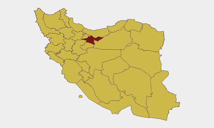
Tehran Province dominates the sub-national risk ranking (98.5), reflecting its role as the capital and primary target for aerial operations and air defence activity. Southern provinces—Hormozgan, Khuzestan, Bushehr, and Fars—all score 69–70, driven by sustained airstrikes, proximity to the Strait of Hormuz blockade, and maritime disruption. East Azerbaijan and Razavi Khorasan score 68.9–69.4, indicating elevated risk from cross-border military activity and potential strikes on defense infrastructure. Risk is distributed across the country rather than isolated to single regions, reflecting nationwide internet disruption, potential for sudden escalation, and widespread exposure to both air defence and kinetic activity.
How GeoBit Would Assist
Security teams should deploy Conflict & Military tracking and battle mapping to monitor strike locations, air defence activation, and force movement in real time. AOI Monitoring with alerting on Tehran, southern ports, and Strait of Hormuz approaches provides early warning of renewed kinetic activity and blockade enforcement. Maritime & Aviation tracking combined with Routing & Network Analysis enables alternative route planning for personnel and cargo, critical given port closures and air space closure.
7-Day Outlook
Military posturing and rhetoric suggest high risk of renewed kinetic operations within 7 days, particularly if diplomatic talks stall. Internet restoration is unlikely in the near term, and maritime blockade and air defence readiness will remain elevated. Personnel in Tehran and southern provinces should prepare for potential short-notice escalation, flight cancellations, and extended communications blackouts.
Highest-Risk Areas — Ranked
| # | State / Region | Risk |
|---|---|---|
| 1 | Tehran Province | 98.5 |
| 2 | Isfahan Province | 70.6 |
| 3 | Hormozgan Province | 70 |
| 4 | Khuzestan Province | 69.8 |
| 5 | Bushehr Province | 69.7 |
| 6 | East Azerbaijan Province | 69.4 |
| 7 | Fars Province | 69.2 |
| 8 | Gilan Province | 69.1 |
| 9 | Sistan and Baluchestan Province | 69.1 |
| 10 | Razavi Khorasan | 68.9 |
| 11 | Kerman Province | 68.9 |
| 12 | Zanjan Province | 68.8 |
Sources
Previous Daily Briefs
A new Iran brief is written every day — each with its own risk map and downloadable CSV. Here's the last week; use the calendar to go further back.
📅 Browse every day by calendar →
Highlighted days have a brief. Tap a day for that day's map & analysis, or “csv” for that day's dataset ($5).
Atlas — our AI intelligence desk — emails them this snapshot personally. Nothing else, no list.