Situation Summary
Myanmar remains in active civil conflict, with the military junta conducting intensive air and ground operations against armed resistance forces across multiple regions. The last 24–48 hours have seen a sharp escalation in airstrikes targeting civilian areas, particularly in Sagaing and Bago regions, resulting in at least 19 confirmed civilian deaths and continued fragmentation of pro-regime forces. The conflict shows no sign of de-escalation, with airstrikes, armed clashes, and active military operations now routine across rural and semi-urban zones nationwide.
Key Developments
- Taling Kyun Village, Sagaing Township – 27 July 2026 (midnight)
Junta fighter jets from Tada-U Air Base conducted an airstrike on a school in Taling Kyun, killing and injuring civilians as part of a coordinated wave of strikes that claimed at least 11 lives across Sagaing, Paungbyin, Wetlet, and Taungoo townships.
- Lay Lar Myaung Village, Bago Yoma, Taungoo District – 27 July 2026
Military airstrike killed eight residents in the Bago Region, representing a secondary axis of junta air operations extending beyond traditional stronghold areas in Sagaing.
- Myaing Township, Magway Region – 27 July 2026
Myaing Garuda PDF captured two police officers and weapons after they became separated from a military column, indicating active armed resistance capability and risk of ambush along local routes.
- Tamu area, Sagaing Region – 27 July 2026
One Soldiers of the National Army (SNA) member defected, continuing a pattern of personnel attrition within junta-aligned forces along the strategically contested Kale–Khampat–Tamu corridor.
- Maungdaw Township, Rakhine State – 27 July 2026
Arakan Army (AA) removed 67 military-planted landmines, confirming persistent explosive contamination of civilian infrastructure and travel routes.
- Kale–Khampat–Tamu Corridor, Sagaing Region – 24–25 July (operationally active through 28 July)
Tamu Emergency Administration Committee issued travel warnings for heavy artillery shelling and airstrikes on the Asian Highway; road access remained restricted as of 26 July with civilian relocation advised, indicating sustained military pressure and transport risk in this critical corridor.
Highest-Risk Areas
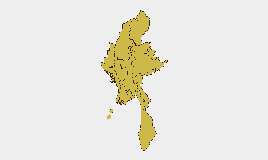
All twelve sub-national regions currently score identically at 67.4 risk, reflecting the nationwide character of the conflict. However, Sagaing Region stands out operationally: it has absorbed the densest concentration of airstrikes and ground clashes in the last 48 hours, with five separate incident clusters (Taling Kyun, Sagaing Township, Paungbyin, Wetlet, Tamu). Tanintharyi, Shan, and Kachin states remain elevated due to sustained armed group activity and mountainous terrain favoring ambush and clandestine operations. Yangon and Naypyitaw, while scoring equally, carry distinct risks: political detention and urban surveillance in the capital, versus transit vulnerability on major road corridors in Sagaing and Magway.
How GeoBit Would Assist
Security teams should employ AOI Monitoring & Early Warning to track airbase activity (Tada-U and others) with persistent satellite and SIGINT watch for airstrike patterns. Routing & Network Analysis would identify safe alternative routes around the Kale–Khampat–Tamu corridor and other high-conflict zones, integrating real-time conflict mapping. Event feed and OSINT fusion (Twitter, Telegram, resistance media) would provide 12–24 hour early warning of localized clashes, detentions, and mine-clearing operations, enabling duty-of-care teams to adjust staff movements and supply lines preemptively.
7-Day Outlook
Junta air operations are expected to continue or intensify across rural Sagaing, Magway, and Bago as the military attempts to degrade armed resistance logistics. Defections and minor resistance wins (weapon captures, mine removal) suggest morale fracturing within pro-regime forces but do not yet signal a shift in military momentum. Movement along major highways (Asian Highway, Kale–Khampat–Tamu) will remain high-risk; civilian areas near airfields and military positions should be treated as restricted.
Highest-Risk Areas — Ranked
| # | State / Region | Risk |
|---|---|---|
| 1 | Tanintharyi Region | 67.4 |
| 2 | Shan State | 67.4 |
| 3 | Chin | 67.4 |
| 4 | Sagaing Region | 67.4 |
| 5 | Kachin State | 67.4 |
| 6 | Wa State (Northern Region) | 67.4 |
| 7 | Magway | 67.4 |
| 8 | Mandalay | 67.4 |
| 9 | Rakhine | 67.4 |
| 10 | Ayeyarwady | 67.4 |
| 11 | Yangon | 67.4 |
| 12 | Naypyitaw Union Territory | 67.4 |
Sources
Previous Daily Briefs
A new Myanmar brief is written every day — each with its own risk map and downloadable CSV. Here's the last week; use the calendar to go further back.
📅 Browse every day by calendar →
Highlighted days have a brief. Tap a day for that day's map & analysis, or “csv” for that day's dataset ($5).
Atlas — our AI intelligence desk — emails them this snapshot personally. Nothing else, no list.