Situation Summary
Myanmar remains in sustained civil conflict between the military junta and distributed armed-opposition forces (PDFs, ethnic armies), with no signs of de-escalation as of late July 2026. The past 48 hours have seen a sharp spike in coordinated military airstrikes against civilian areas across central Myanmar's Sagaing and Bago regions, resulting in at least 11 confirmed civilian deaths on 27 July alone. Overall threat trajectory remains upward, driven by tactical intensity in multiple sub-national zones rather than strategic movement toward negotiation or ceasefire.
Key Developments
- Sagaing Region airstrike cluster (27 July): Myanmar Air Force jets from Tada-U Air Base bombed Taling Kyun Village school in Sagaing Township, killing a married couple (U Daung Lin, 45; Daw San Lwin, 44) and destroying four school buildings and three homes. Concurrent strikes in Paungbyin and Wetlet townships (Sagaing) also reported on same date.
- Bago Region airstrike (27 July): Military conducted airstrike on Lay Lar Myaung Village in Bago Yoma area, Taungoo District, killing at least eight residents according to local opposition-linked reporting.
- Coordinated multi-location civilian toll (27 July): Combined strikes across Sagaing Township, Paungbyin, Wetlet, and Taungoo districts resulted in at least 11 confirmed civilian deaths, consistent with recent escalation pattern in central dry zone documented by international conflict monitors.
- Police officer capture (27 July): Myaing Garuda PDF captured two police officers in Myaing Township, Magway Region, after they became separated from a military column; weapons and ammunition seized.
- Border-area artillery activity (24–25 July context): Heavy shelling and airstrikes reported along Kale–Khampat–Tamu corridor in Sagaing's border zone with India; local authorities issued urgent travel warnings. One SNA soldier defection recorded in Tamu area on 27 July.
- Landmine clearance (27 July): Arakan Army completed clearance of 67 mines in Maungdaw Township, Rakhine State, planted by military and extremist groups—reflects AA consolidation of territorial control in northern Rakhine.
- Arrest/detention activity (28 July): Government arrest/detention incident recorded, though open-source detail remains limited.
Highest-Risk Areas
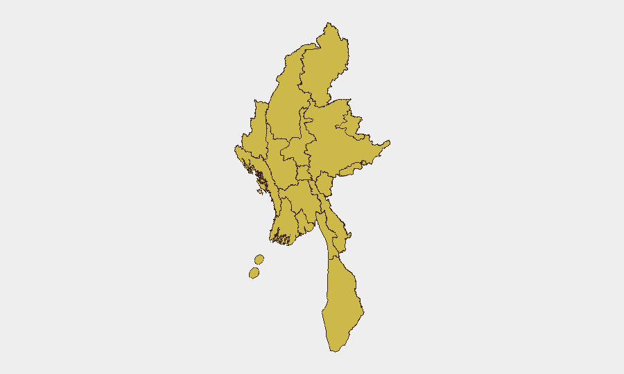
All 12 tracked sub-national zones show identical composite risk scores (67.7), reflecting widespread conflict saturation across Myanmar. However, Sagaing Region and Magway stand out as immediate flashpoints due to 27 July airstrike clustering, active PDF operations, and ongoing border shelling near India. Rakhine State and Shan State remain volatile due to continued Arakan Army and ethnic-army operations, while Bago Region now shows elevated acute risk following the Taungoo district airstrike. Yangon and Naypyitaw, though nominally lower-intensity, warrant duty-of-care attention given arrest activity and unpredictable security-force sweeps.
How GeoBit Would Assist
Security teams operating in Myanmar should leverage AOI Monitoring & Early Warning on high-risk townships (Sagaing, Paungbyin, Bago Yoma, Myaing) with persistent alerting on military airbase activity and opposition-force movements. Battle Mapping and Force Structure tracking would clarify military-unit positions and PDF/ethnic-army operational zones in real time. Routing & Network Analysis would supply vetted alternative travel corridors, particularly around Sagaing–Magway border areas and the India–Myanmar frontier, circumventing active conflict zones.
7-Day Outlook
Airstrike tempo in central Myanmar is likely to remain elevated through early August, with Sagaing and Bago regions as primary impact zones. Armed-opposition operations (PDF, SNA, AA) will continue localized strikes and territorial consolidation, especially in border and ethnic-minority areas. Travel restrictions and curfews in affected townships should be anticipated; humanitarian access and civilian protection remain minimal.
Highest-Risk Areas — Ranked
| # | State / Region | Risk |
|---|---|---|
| 1 | Tanintharyi Region | 67.7 |
| 2 | Shan State | 67.7 |
| 3 | Chin | 67.7 |
| 4 | Sagaing Region | 67.7 |
| 5 | Kachin State | 67.7 |
| 6 | Wa State (Northern Region) | 67.7 |
| 7 | Magway | 67.7 |
| 8 | Mandalay | 67.7 |
| 9 | Rakhine | 67.7 |
| 10 | Ayeyarwady | 67.7 |
| 11 | Yangon | 67.7 |
| 12 | Naypyitaw Union Territory | 67.7 |
Previous Daily Briefs
A new Myanmar brief is written every day — each with its own risk map and downloadable CSV. Here's the last week; use the calendar to go further back.
📅 Browse every day by calendar →
Highlighted days have a brief. Tap a day for that day's map & analysis, or “csv” for that day's dataset ($5).
Atlas — our AI intelligence desk — emails them this snapshot personally. Nothing else, no list.