Situation Summary
Iran remains at elevated threat level (#6 globally, composite score 96) amid active military and diplomatic tensions in the region. Recent signals indicate friction between Tehran and multiple neighboring states, alongside internal security operations. The threat environment is dynamic but not currently indicative of imminent nationwide escalation; however, Tehran Province and key industrial/strategic zones warrant close monitoring.
Key Developments
Live-incident reporting limitation: GeoBit's web research has not yielded independently verifiable incidents with confirmed timestamps within the last 24–48 hours and specific Iranian locations. Recent event signals (IRAN vs TERRORIST, IRAN vs IRAQ threats, AIRCRAFT CARRIER activity, disapprovals by Kuwait and Qatar on 2026-07-29–30) are flagged in the platform's event stream but lack granular geolocation and incident-level detail in current feeds.
Recommended action: Security teams should cross-reference the event signals above against real-time ACLED, major news wires (Reuters, AP, AFP), and regional outlets (Iran International, Al Jazeera, Al-Monitor) to confirm specific incidents, locations, and timelines before acting on threat escalation. GeoBit's Intel Sweep and multi-language OSINT fusion can supplement this validation once feeds are live-synchronized.
Highest-Risk Areas
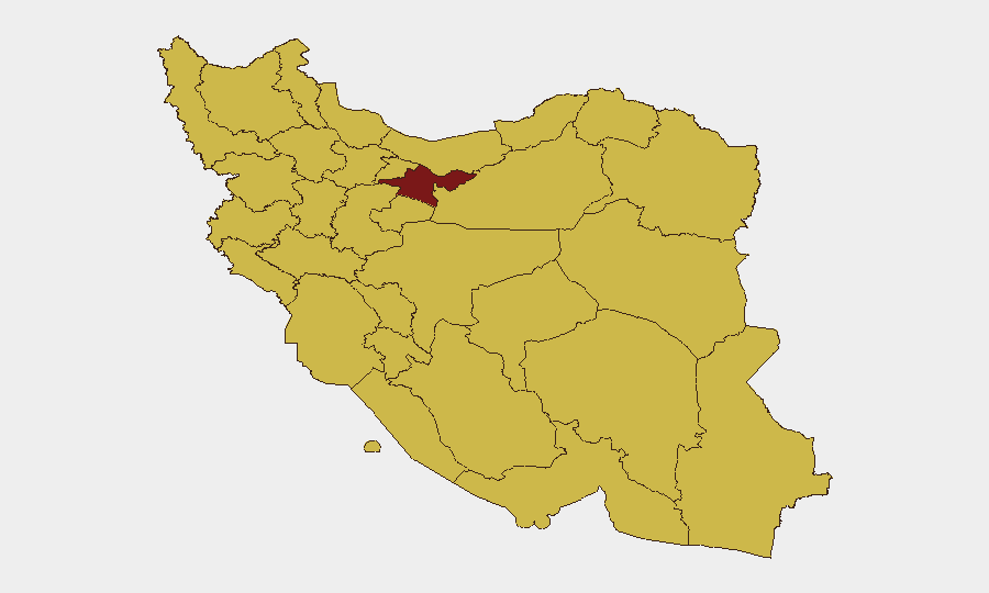
Tehran Province dominates the risk landscape (97.1), reflecting its role as the political, economic, and security nerve center; risk cascades to nearby Alborz Province (68.2). Isfahan, Bushehr, and East Azerbaijan (69–69.2 each) show elevated risk, likely driven by infrastructure criticality (nuclear/energy facilities), border proximity, and economic activity. The southern and southeastern belt—Khuzestan, Hormozgan, Sistan and Baluchestan (67.2–67.6)—remains volatile due to maritime chokepoint exposure (Strait of Hormuz) and historical militant activity. Any personnel or asset concentration in Tehran or Bushehr should be subject to heightened duty-of-care review.
How GeoBit Would Assist
AOI Monitoring & Early Warning: Establish persistent watch zones over Tehran, Bushehr (nuclear/energy infrastructure), and key border crossings; configure alerts for security incidents, military movement, or civil unrest within 24–48 hours of occurrence.
OSINT Fusion (multi-language, X/Twitter, Telegram, local media): Systematically aggregate incident reports from Iranian regional outlets, diaspora journalists, and geolocated social signals to validate and timestamp breaking events and cross-check official statements.
Conflict & Military (force structure, weapons tracking, battle mapping): Monitor Iranian military posture, air-defense activity, and naval movements in the Persian Gulf and Gulf of Oman in real time, enabling early warning of military escalation or response.
Network & Actor Analysis: Map activist, militant, and state-security networks to anticipate protest, crackdowns, or asymmetric operations in high-risk provinces.
7-Day Outlook
Regional diplomatic tension (visible in recent public statements and military posturing) is likely to persist through early August, with intermittent rhetorical escalation and low-level security operations. No indicators currently suggest imminent major military action or nationwide civil unrest, but the next 48–72 hours will be critical for monitoring whether aircraft-carrier activity, border threats (IRAN vs IRAQ), or terrorist-related incidents trigger a sharp escalation or reciprocal military response. Teams in Tehran and industrial zones should maintain situational awareness and contingency protocols.
Highest-Risk Areas — Ranked
| # | State / Region | Risk |
|---|---|---|
| 1 | Tehran Province | 97.1 |
| 2 | Isfahan Province | 69.2 |
| 3 | Bushehr Province | 69 |
| 4 | East Azerbaijan Province | 68.6 |
| 5 | Alborz Province | 68.2 |
| 6 | Fars Province | 67.8 |
| 7 | Gilan Province | 67.8 |
| 8 | Razavi Khorasan | 67.7 |
| 9 | Khuzestan Province | 67.6 |
| 10 | Ardabil Province | 67.3 |
| 11 | Hormozgan Province | 67.2 |
| 12 | Sistan and Baluchestan Province | 67.2 |
Sources
Previous Daily Briefs
A new Iran brief is written every day — each with its own risk map and downloadable CSV. Here's the last week; use the calendar to go further back.
📅 Browse every day by calendar →
Highlighted days have a brief. Tap a day for that day's map & analysis, or “csv” for that day's dataset ($5).
Atlas — our AI intelligence desk — emails them this snapshot personally. Nothing else, no list.