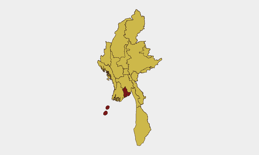
Situation Summary
Myanmar remains in acute civil conflict following the February 2021 military coup, with the junta prosecuting a nationwide campaign against armed resistance forces and civilian populations. The past 48 hours have marked a sharp escalation in aerial bombardment of civilian areas across Sagaing and Bago regions, with at least 19 confirmed civilian deaths and multiple villages targeted. Personnel attrition within junta-aligned militias, ongoing forced conscription sweeps, and persistent explosive hazards continue to fragment state control and elevate risk across urban and rural zones. The conflict trajectory remains unstable, with no ceasefire framework and active inter-factional competition for territory and supply lines.
Key Developments
- Sagaing Region airstrikes (29 July): Junta aircraft conducted coordinated strikes on Sagaing Township, Paungbyin Township, Wetlet Township, and Taling Kyun village area, killing at least 11 civilians and destroying civilian infrastructure. Strikes originated from Tada-U Air Base and targeted both populated areas and a school, marking a pattern shift toward less discriminate targeting in resistance-held zones.
- Bago Region escalation (29 July): Military airstrikes on Taungoo District killed eight civilians and represent expansion of air operations beyond traditional conflict strongholds, signaling widened military campaign scope.
- Kayin State vehicle bombing aftermath (27–28 July): A car bomb near a Karen National Army checkpoint in Myawaddy Township killed seven and wounded nine on 27 July; heightened security posture and movement restrictions remain in place, affecting cross-border trade and civilian transit.
- SNA defection (Sagaing, 28–29 July): One member of the junta-aligned Soldiers of the National Army defected along the strategic Kale–Khampat–Tamu corridor, consistent with observed personnel attrition reducing junta operational capacity in northwestern zones.
- Mine clearance operation (Rakhine, 27–28 July): The Arakan Army cleared 67 landmines from Maungdaw Township civilian infrastructure and travel routes, reducing immediate explosive hazard but underscoring ongoing contamination of populated areas.
- Forced conscription sweeps (nationwide, 27–29 July): "Military Service Batch 27" detentions and recruitment operations accelerated across multiple regions over the past 48 hours, driving displacement and heightening civil unrest, particularly among working-age and displaced populations.
Highest-Risk Areas
Yangon's risk score of 97.8 reflects concentration of military, state institutions, and resistance networks in a densely populated urban setting with frequent arrests, detentions, and surveillance operations. Sagaing Region (67.8) and Bago Region (67.8) have emerged as primary loci of kinetic escalation in the past 48 hours, with airstrikes targeting civilian areas and villages in active support zones. Mandalay (68.9) remains a secondary urban flashpoint with reported military disapproval events and infrastructure pressure. The clustering of eight sub-national zones at 67.8 reflects the diffuse, multi-front character of the civil war, with active guerrilla and police-vs.-civilian force operations distributed across northern (Kachin, Shan, Sagaing) and southern (Tanintharyi, Rakhine, Ayeyarwady) borderlands.
How GeoBit Would Assist
Security and duty-of-care teams should employ Intel Sweep and OSINT fusion capabilities to monitor real-time airstrike reporting, military movement signals, and resistance-linked updates across Telegram, X, and local news feeds. AOI Monitoring & Early Warning on high-risk regions (Sagaing, Bago, Myawaddy corridor) enables persistent detection of escalation patterns, airfield activity, and checkpoint placement before incidents affect personnel. Routing & Network Analysis identifies safer transit corridors and alternative supply chains around active conflict zones and landmine-contaminated routes, reducing exposure to vehicle bombs and military interdiction.
7-Day Outlook
The intensity of airstrikes and forced conscription suggests the junta is pursuing a high-casualty attrition strategy in resistance strongholds over the near term. Cross-border spillover risk remains elevated, particularly in Kayin and Sagaing, following the Myawaddy bombing and continued SNA fragmentation. Corporate teams with personnel or supply chains in Sagaing, Bago, and Kayin should assume heightened volatility and checkpoint intensity for the next 7–14 days.
Highest-Risk Areas — Ranked
| # | State / Region | Risk |
|---|---|---|
| 1 | Yangon | 97.8 |
| 2 | Mandalay | 68.9 |
| 3 | Tanintharyi Region | 67.8 |
| 4 | Shan State | 67.8 |
| 5 | Chin | 67.8 |
| 6 | Sagaing Region | 67.8 |
| 7 | Kachin State | 67.8 |
| 8 | Wa State (Northern Region) | 67.8 |
| 9 | Magway | 67.8 |
| 10 | Rakhine | 67.8 |
| 11 | Ayeyarwady | 67.8 |
| 12 | Naypyitaw Union Territory | 67.8 |
Sources
Previous Daily Briefs
A new Myanmar brief is written every day — each with its own risk map and downloadable CSV. Here's the last week; use the calendar to go further back.
📅 Browse every day by calendar →
Highlighted days have a brief. Tap a day for that day's map & analysis, or “csv” for that day's dataset ($5).
Atlas — our AI intelligence desk — emails them this snapshot personally. Nothing else, no list.