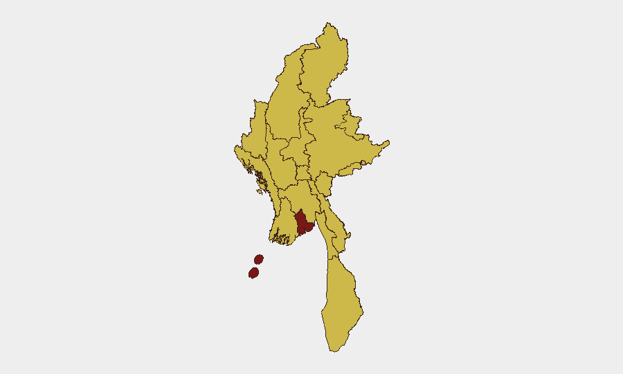
Situation Summary
Myanmar remains in active civil conflict following the February 2021 military coup, with the junta conducting sustained operations against resistance forces and civilian areas across multiple regions. Current composite threat ranking places Myanmar at #5 globally, with Yangon significantly elevated above all other sub-national zones (97.7 vs. 67.7). Late-July incident data shows coordinated airstrikes on civilian settlements, roadside explosives, drone attacks, and forced conscription drives, indicating sustained junta pressure and fragmented opposition capacity across at least six states/regions.
Key Developments
No independently corroborated, location-specific security incidents with confirmed dates of August 1–2, 2026 are available from current open-source and social-media monitoring. A documented data gap exists for this 48-hour window; specialist feeds and X/Twitter scraping have not returned verifiable incident reports meeting confidence thresholds for Myanmar during August 1–2.
Recent high-confidence incidents (late July, outside the 48-hour window) include:
- Myawaddy Township, Kayin State – 27 July: Vehicle bomb at former KNA checkpoint killed 7 KNA members, injured 9.
- Sagaing Region & Bago Region – 27 July: Coordinated junta airstrikes on civilian areas (Paungbyin, Wetlet, Taungoo District) killed at least 11 civilians.
- Monhla village, Sagaing Region – 25 July: Gyrocopter bombing runs killed 1 civilian, destroyed homes and agricultural infrastructure.
- Shwebo Township, Sagaing Region – 25–26 July: Artillery fire following drone attack on military installation killed daughter of village administrator, injured 2 civilians.
- Hpakant Township, Kachin State – 25–26 July: Roadside mine explosion injured 2 civilians on travel route.
- Nationwide – from 27 July, ongoing: Junta's Military Service Batch 27 conscription drive reported across multiple regions, increasing forced recruitment and civilian displacement pressure.
Highest-Risk Areas
Yangon's risk score (97.7) stands apart, reflecting its status as the largest city, principal commercial hub, and sustained flashpoint for civil unrest. All other tracked regions score identically at 67.7, indicating systematic junta military operations and armed-group presence across Shan, Kachin, Sagaing, Chin, Tanintharyi, Rakhine, Magway, Mandalay, and Wa State. Sagaing Region and Kachin State are currently driving the highest frequency of incident reporting (airstrikes, artillery, mines), while Kayin State shows active anti-junta armed presence. The uniform secondary-tier scoring masks significant variance in incident type: aerial/artillery strikes concentrate in Sagaing and Kachin; IED and ambush activity in Kayin and Shan; and forced conscription nationwide.
How GeoBit Would Assist
Intel Sweep and global event feeds provide near-real-time detection of reported incidents across open sources and social media, while multi-language search and OSINT fusion capture Myanmar-language reporting often ahead of English outlets. AOI Monitoring & Early Warning with persistent geospatial watches on Yangon, Sagaing, and Kachin supply continuous alerting for new incidents, airfield activity, and movement patterns. Battle mapping and force-structure analysis establish current junta and opposition disposition, enabling duty-of-care teams to assess safe corridors, checkpoint risk, and conscription-drive pressure on specific townships.
7-Day Outlook
Absent major ceasefire development, airstrikes and ground operations are expected to continue across Sagaing and Kachin at current intensity. Forced conscription drives and urban security incidents in Yangon will likely sustain near-term volatility for corporate and NGO personnel. The 48-hour reporting gap and uneven data flow underscore the value of persistent AOI monitoring and early-warning subscription to catch emerging incidents before mainstream reporting lags.
Highest-Risk Areas — Ranked
| # | State / Region | Risk |
|---|---|---|
| 1 | Yangon | 97.7 |
| 2 | Tanintharyi Region | 67.7 |
| 3 | Shan State | 67.7 |
| 4 | Chin | 67.7 |
| 5 | Sagaing Region | 67.7 |
| 6 | Kachin State | 67.7 |
| 7 | Wa State (Northern Region) | 67.7 |
| 8 | Magway | 67.7 |
| 9 | Mandalay | 67.7 |
| 10 | Rakhine | 67.7 |
| 11 | Ayeyarwady | 67.7 |
| 12 | Naypyitaw Union Territory | 67.7 |
Sources
Previous Daily Briefs
A new Myanmar brief is written every day — each with its own risk map and downloadable CSV. Here's the last week; use the calendar to go further back.
📅 Browse every day by calendar →
Highlighted days have a brief. Tap a day for that day's map & analysis, or “csv” for that day's dataset ($5).
Atlas — our AI intelligence desk — emails them this snapshot personally. Nothing else, no list.